MyTopo
Gunsight Draw Texas US Topo Map
Couldn't load pickup availability
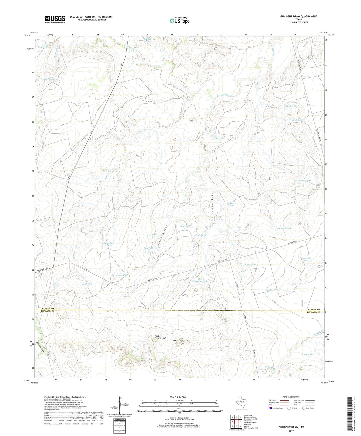
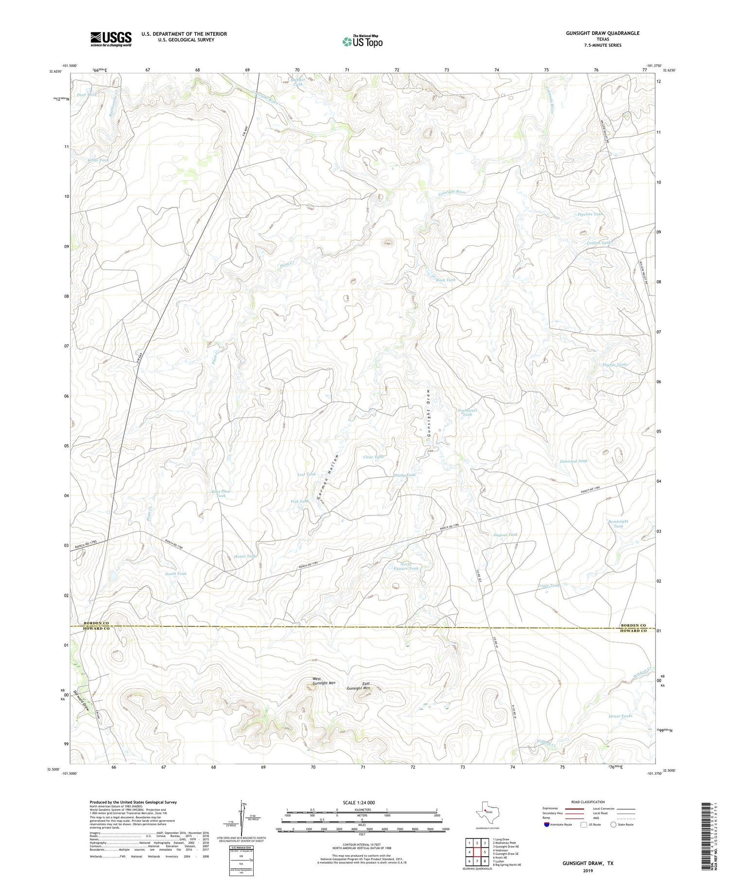
2019 topographic map quadrangle Gunsight Draw in the state of Texas. Scale: 1:24000. Based on the newly updated USGS 7.5' US Topo map series, this map is in the following counties: Borden, Howard. The map contains contour data, water features, and other items you are used to seeing on USGS maps, but also has updated roads and other features. This is the next generation of topographic maps. Printed on high-quality waterproof paper with UV fade-resistant inks.
Quads adjacent to this one:
West: Vealmoor
Northwest: Long Draw
North: Mushaway Peak
Northeast: Gunsight Draw NE
East: Gunsight Draw SE
Southeast: Big Spring North NE
South: Luther
Southwest: Knott NE
Contains the following named places: Bombsight Tank, Catfish Tank, Clear Tank, Deep Tank, Diamond Tank, Double Tanks, Dugout Tank, East Gunsight Mountain, Fish Tank, German Hollow, Gunsight Draw, House Tank, House Tanks, Lost Tank, Munger Tank, North Pasture Tank, Pipeline Tank, Plum Creek, Rattlesnake Creek, Rock Tank, Root Plow Tank, Shady Tank, South Tank, Southwest Tank, Triple Tanks, West Gunsight Mountain, White Tank