MyTopo
Gunsight Draw SE Texas US Topo Map
Couldn't load pickup availability
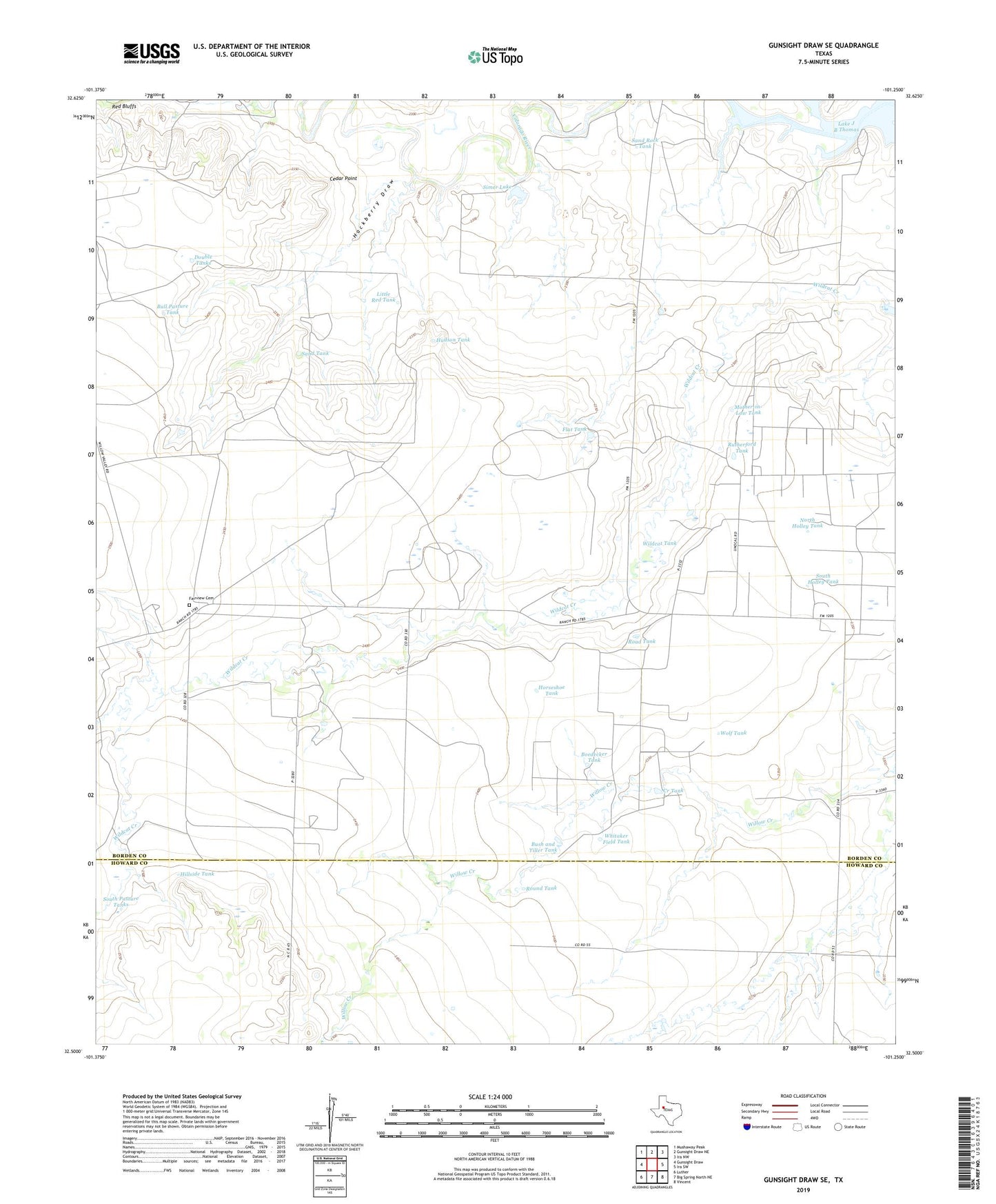
2022 topographic map quadrangle Gunsight Draw SE in the state of Texas. Scale: 1:24000. Based on the newly updated USGS 7.5' US Topo map series, this map is in the following counties: Borden, Howard. The map contains contour data, water features, and other items you are used to seeing on USGS maps, but also has updated roads and other features. This is the next generation of topographic maps. Printed on high-quality waterproof paper with UV fade-resistant inks.
Quads adjacent to this one:
West: Gunsight Draw
Northwest: Mushaway Peak
North: Gunsight Draw NE
Northeast: Ira NW
East: Ira SW
Southeast: Vincent
South: Big Spring North NE
Southwest: Luther
This map covers the same area as the classic USGS quad with code o32101e3.
Contains the following named places: Boedecker Tank, Bull Pasture Tank, Bush and Tiller Tank, Cedar Point, Creek Tank, Double Tanks, East Vealmoor Oil Field, Fairview Cemetery, Flat Tank, Hackberry Draw, Hillside Tank, Hobo Oil Field, Horseshoe Tank, Hudson Tank, Hullem Creek, Little Red Tank, Mother-in-Law Tank, North Holley Tank, Red Bluffs, Reineke Vincent Oil Field, Road Tank, Round Tank, Rutherford Tank, Sand Rock Tank, Sand Tank, Simer Lake, Simer Lake Dam, South Holley Tank, South Pasture Tanks, Whitaker Field Tank, Wildcat Tank, Wolf Tank