MyTopo
Gunsight Draw NE Texas US Topo Map
Couldn't load pickup availability
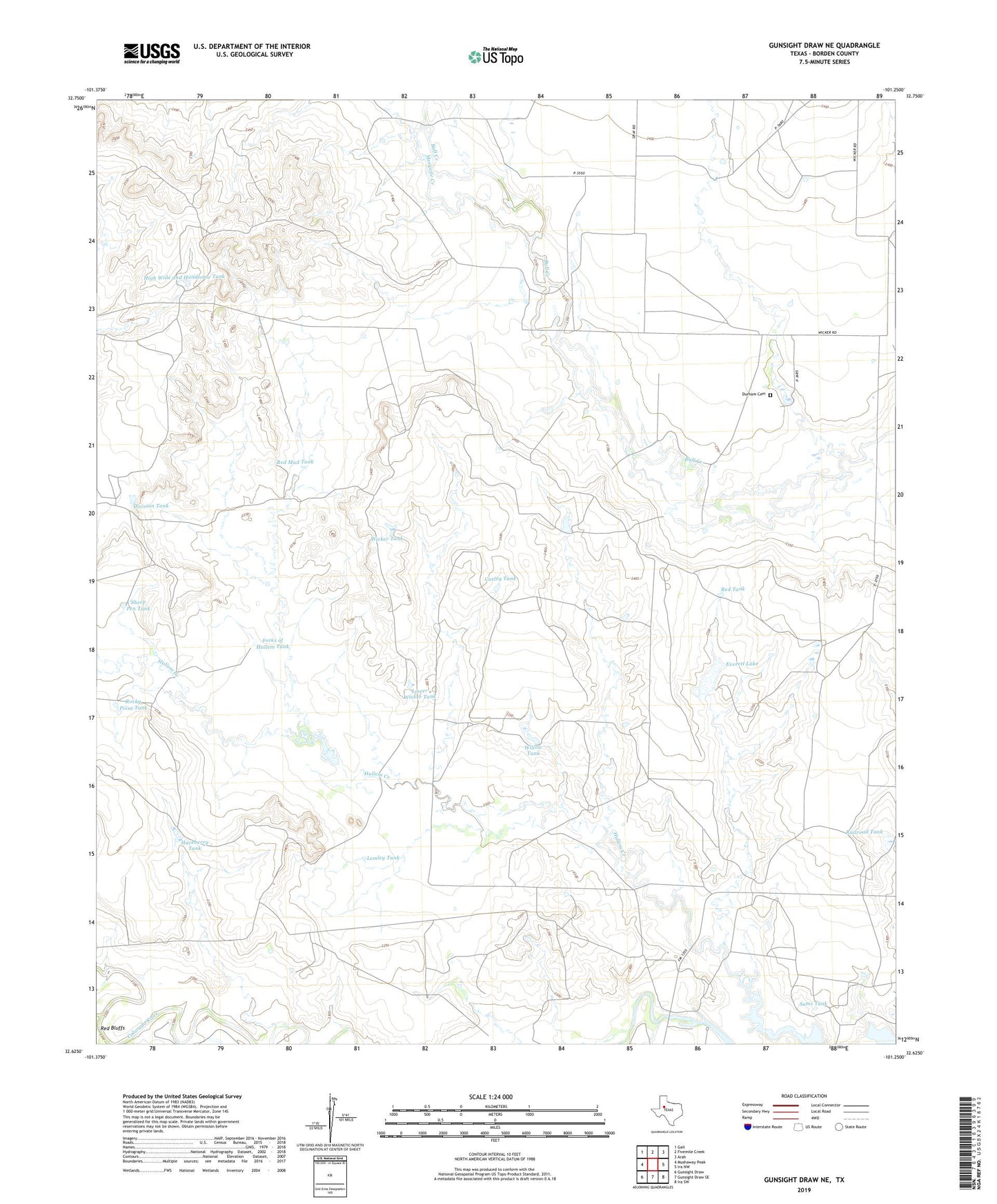
2022 topographic map quadrangle Gunsight Draw NE in the state of Texas. Scale: 1:24000. Based on the newly updated USGS 7.5' US Topo map series, this map is in the following counties: Borden. The map contains contour data, water features, and other items you are used to seeing on USGS maps, but also has updated roads and other features. This is the next generation of topographic maps. Printed on high-quality waterproof paper with UV fade-resistant inks.
Quads adjacent to this one:
West: Mushaway Peak
Northwest: Gail
North: Fivemile Creek
Northeast: Arah
East: Ira NW
Southeast: Ira SW
South: Gunsight Draw SE
Southwest: Gunsight Draw
This map covers the same area as the classic USGS quad with code o32101f3.
Contains the following named places: Curley Tank, Division Tank, Durham Cemetery, Everett Lake, Everett Lake Dam, Forks of Hullem Tank, Hackberry Tank, High Wide and Handsome Tank, Lemley Tank, Lower Wicker Tank, Mesquite Creek, Railroad Tank, Red Mud Tank, Red Tank, Rocky Point Tank, Sams Tank, Sheep Pen Tank, Wicker Tank, Willow Tank