MyTopo
Hallettsville Texas US Topo Map
Couldn't load pickup availability
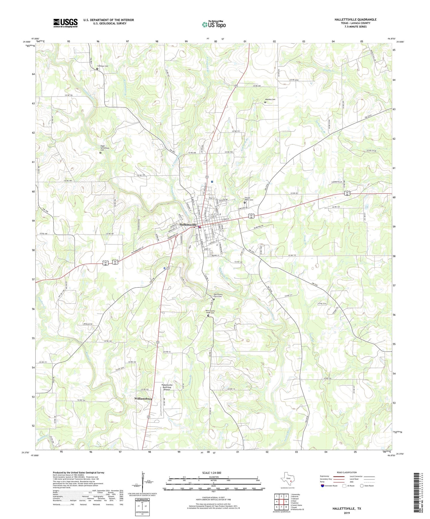
2019 topographic map quadrangle Hallettsville in the state of Texas. Scale: 1:24000. Based on the newly updated USGS 7.5' US Topo map series, this map is in the following counties: Lavaca. The map contains contour data, water features, and other items you are used to seeing on USGS maps, but also has updated roads and other features. This is the next generation of topographic maps. Printed on high-quality waterproof paper with UV fade-resistant inks.
Quads adjacent to this one:
West: Wied
Northwest: Komensky
North: Moravia
Northeast: Oakland
East: Sublime
Southeast: Hallettsville SE
South: Ezzell
Southwest: Sweet Home
Contains the following named places: Campbell Branch, Church of the Immaculate Conception of Blessed Virgin Mary, City of Hallettsville, Coleman Cemetery, East Campbell Branch, Good Hope, Good Hope Church, Hallettsville, Hallettsville City Hall, Hallettsville City Park, Hallettsville Elementary School, Hallettsville Fire Department, Hallettsville Fire Marshal's Office, Hallettsville High School, Hallettsville Junior High School, Hallettsville Municipal Airport, Hallettsville Oil Field, Hallettsville Police Department, Hallettsville Post Office, KRJH-AM (Hallettsville), Lavaca County, Lavaca County EMS, Lavaca County Jail, Lavaca County Sheriff's Office, Lavaca Historical Museum, Lavaca Medical Center, Lay-Bozka House, Light Chapel, Light Chapel Church, Mikeska Cemetery, Municipal Stadium, Mustang Creek, New County Farm Cemetery, Old County Farm Cemetery, Pagel Settlement Cemetery, Rickaway Branch, Sacred Heart Cemetery, Saint James Episcopal Church, Saint Marys Church, Smothers Creek, Stevens-Mayo High School, West Campbell Branch, Williamsburg, Word Oil Field