
MyTopo
Hammond Texas US Topo Map
Couldn't load pickup availability
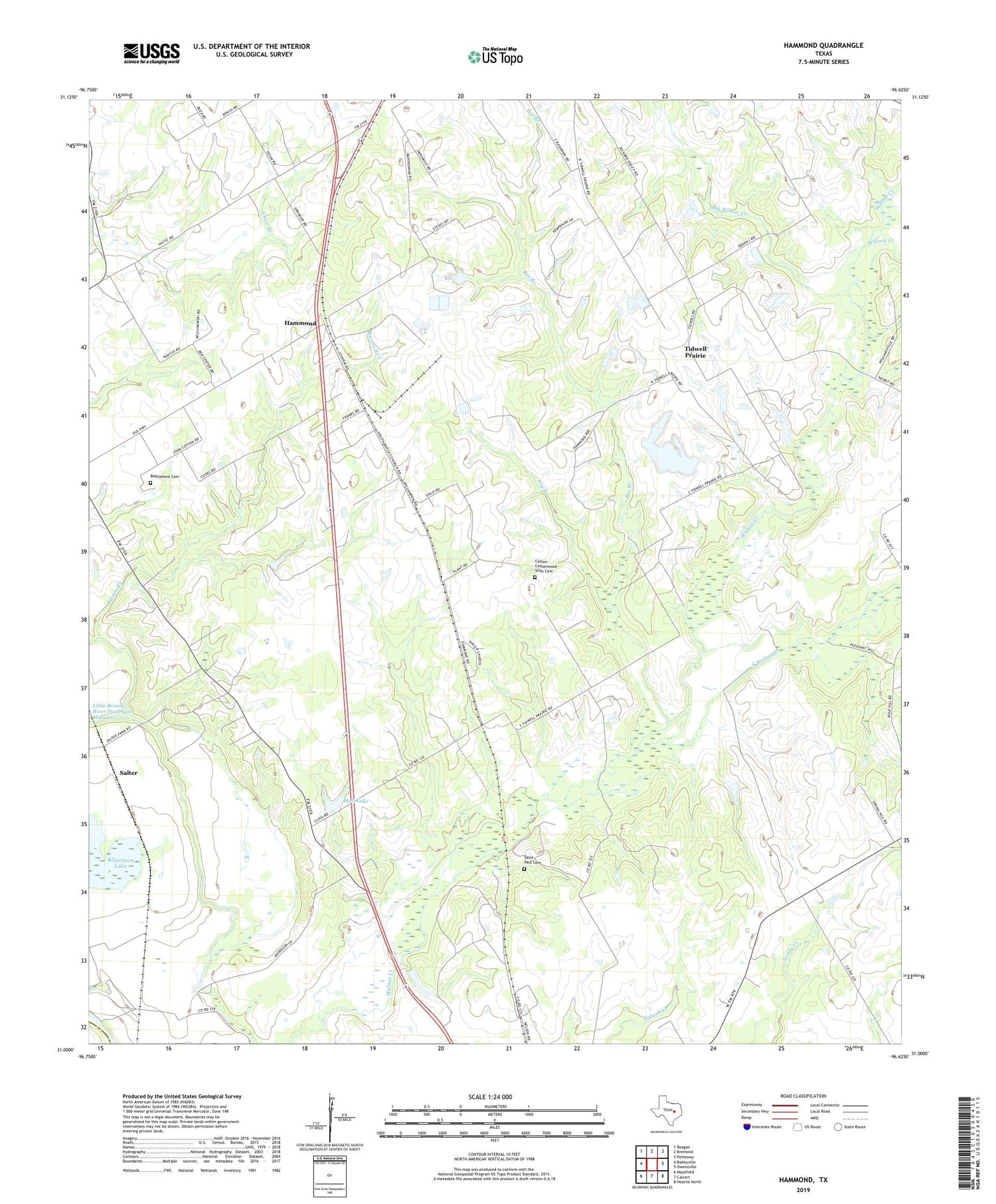
2019 topographic map quadrangle Hammond in the state of Texas. Scale: 1:24000. Based on the newly updated USGS 7.5' US Topo map series, this map is in the following counties: Robertson, Milam. The map contains contour data, water features, and other items you are used to seeing on USGS maps, but also has updated roads and other features. This is the next generation of topographic maps. Printed on high-quality waterproof paper with UV fade-resistant inks.
Quads adjacent to this one:
West: Baileyville
Northwest: Reagan
North: Bremond
Northeast: Petteway
East: Owensville
Southeast: Hearne North
South: Calvert
Southwest: Maysfield
Contains the following named places: Anderson School, Barton Branch, Bee Branch, Bethlehem Cemetery, Bethlehem Church, Big Willow Creek, Cotton - Cottonwood - Shilo Cemetery, Dry Branch, Hall Dam, Hall Lake, Hammond, Hammond High School, Jericho Church, Morning Star Church, Mount Moriah Church, Robertson Lake, Saint Paul Cemetery, Saint Paul Church, Salter, Shiloh Church, South Walnut Creek, Spring Hill Church, Tidwell Prairie, Willson Creek, ZIP Code: 77837


