MyTopo
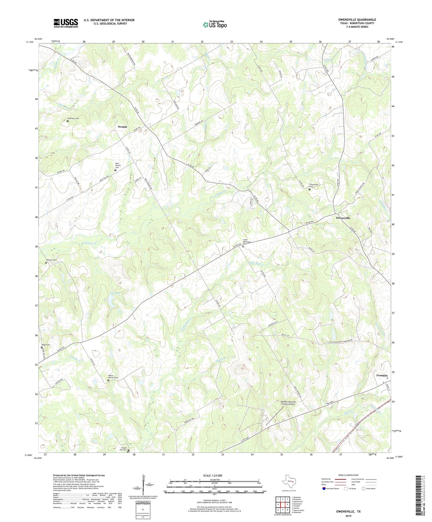
Owensville Texas US Topo Map
Couldn't load pickup availability
2022 topographic map quadrangle Owensville in the state of Texas. Scale: 1:24000. Based on the newly updated USGS 7.5' US Topo map series, this map is in the following counties: Robertson. The map contains contour data, water features, and other items you are used to seeing on USGS maps, but also has updated roads and other features. This is the next generation of topographic maps. Printed on high-quality waterproof paper with UV fade-resistant inks.
Quads adjacent to this one:
West: Hammond
Northwest: Bremond
North: Petteway
Northeast: Bald Prairie
East: Franklin
Southeast: Wheelock
South: Hearne North
Southwest: Calvert
This map covers the same area as the classic USGS quad with code o31096a5.
Contains the following named places: Anderson Cemetery, Barton Branch, Beck Prairie Church, Caddo Creek, Chapel Hill Cemetery, East Calvert Oil Field, Franklin Lions Stadium, Jackson Cemetery, Little Mississippi Cemetery, Lutz Lake, Lutz Lake Dam, Mount Vernon Cemetery, Nesbitt, Nesbitt Cemetery, Owensville, Owensville Cemetery, Red Bank Creek, Robertson County, Rose Hill Church, Sandbur Ranches Private Airport, Spring Branch, Touchstone Branch, Webb - Gray Cemetery, Wolf Den Branch