MyTopo
Bremond Texas US Topo Map
Couldn't load pickup availability
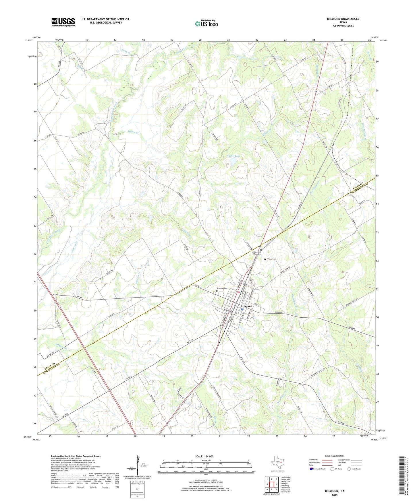
2022 topographic map quadrangle Bremond in the state of Texas. Scale: 1:24000. Based on the newly updated USGS 7.5' US Topo map series, this map is in the following counties: Falls, Robertson. The map contains contour data, water features, and other items you are used to seeing on USGS maps, but also has updated roads and other features. This is the next generation of topographic maps. Printed on high-quality waterproof paper with UV fade-resistant inks.
Quads adjacent to this one:
West: Reagan
Northwest: McClanahan
North: Kosse West
Northeast: Kosse East
East: Petteway
Southeast: Owensville
South: Hammond
Southwest: Baileyville
This map covers the same area as the classic USGS quad with code o31096b6.
Contains the following named places: Bremond, Bremond Cemetery, Bremond City Hall, Bremond Division, Bremond Elementary School, Bremond High School, Bremond Middle School, Bremond Police Department, Bremond Post Office, Bremond Volunteer Fire Department, City of Bremond, Cloverleaf Rest Cemetery, Harper Cemetery, Hogg, Love High School, Pleasant Grove Church, Polecat Creek, Robertson County Constable's Office Precinct 4, Rocky Creek, Saint Mary School, Saint Mary's Cemetery, Salt Branch, Wachel Lake, Wachel Lake Dam, Willow Creek, ZIP Code: 76629