MyTopo
Harvey Creek Texas US Topo Map
Couldn't load pickup availability
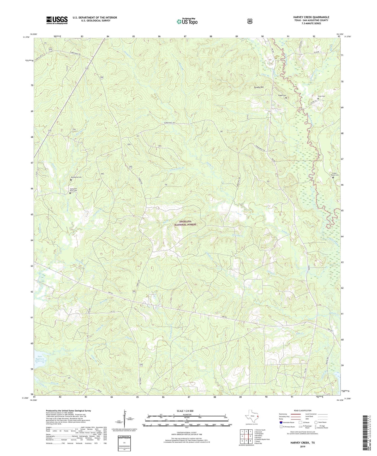
2019 topographic map quadrangle Harvey Creek in the state of Texas. Scale: 1:24000. Based on the newly updated USGS 7.5' US Topo map series, this map is in the following counties: San Augustine. The map contains contour data, water features, and other items you are used to seeing on USGS maps, but also has updated roads and other features. This is the next generation of topographic maps. Printed on high-quality waterproof paper with UV fade-resistant inks.
Quads adjacent to this one:
West: Broaddus
Northwest: Chireno South
North: Norwood
Northeast: Chinquapin
East: Bronson
Southeast: Buck Bay
South: Veach
Southwest: Cassells-Boykin Park
Contains the following named places: Bannister Lake, Bannister Wildlife Management Area, Big Branch, Broaddus Division, Caney Creek, Chinquapin Creek, Clay Branch, Clear Branch, Croker - Boren Cemetery, Crow Cemetery, Franklin Branch, Hebron Church, Herd Pen Creek, Hornsby Creek, Hunts Lake, Little Creek, Macedonia Cemetery, Massa, Nath Beck Cemetery, Pisgah Cemetery, Pisgah Church, Scott Creek, Turkey Creek, Turkey Hill, Turkey Hill Wilderness, Walnut Branch, Wash Branch, White City, Willow Branch, Yellowjacket Branch