MyTopo
Cassells-Boykin Park Texas US Topo Map
Couldn't load pickup availability
Also explore the Cassells-Boykin Park Forest Service Topo of this same quad for updated USFS data
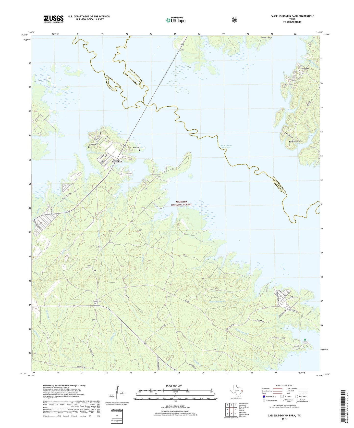
2022 topographic map quadrangle Cassells-Boykin Park in the state of Texas. Scale: 1:24000. Based on the newly updated USGS 7.5' US Topo map series, this map is in the following counties: Angelina, San Augustine, Nacogdoches. The map contains contour data, water features, and other items you are used to seeing on USGS maps, but also has updated roads and other features. This is the next generation of topographic maps. Printed on high-quality waterproof paper with UV fade-resistant inks.
Quads adjacent to this one:
West: Zavalla
Northwest: Etoile South
North: Broaddus
Northeast: Harvey Creek
East: Veach
Southeast: Ebenezer
South: Boykin Spring
Southwest: Rockland
This map covers the same area as the classic USGS quad with code o31094b3.
Contains the following named places: Angelina National Forest, Bayou Springs Creek, Blackbum Branch, Boggy Creek, Boykin Cemetery, Brushy Creek, Caney Creek Recreation Site, Cassell Boykin Park Recreation Site, Cassells-Boykin Park, Cassels Cemetery, Concord Cemetery, Concord Church, Dry Creek, Franklin Branch, Harvey Cemetery, Harvey Creek, Harvey Creek Recreation Site, Hog Branch, Indian Creek, Julia Creek, Little Caney Creek, Miller Cemetery, Monterey Boat Ramp, Monterey Park Campground, Mott Cemetery, Mudd Creek, Pophers Creek, Rayburn Branch, Rayburn Cemetery, Rocky Creek, Runnels Cemetery, Warsaw, Zavalla Division