MyTopo
Hemphill Texas US Topo Map
Couldn't load pickup availability
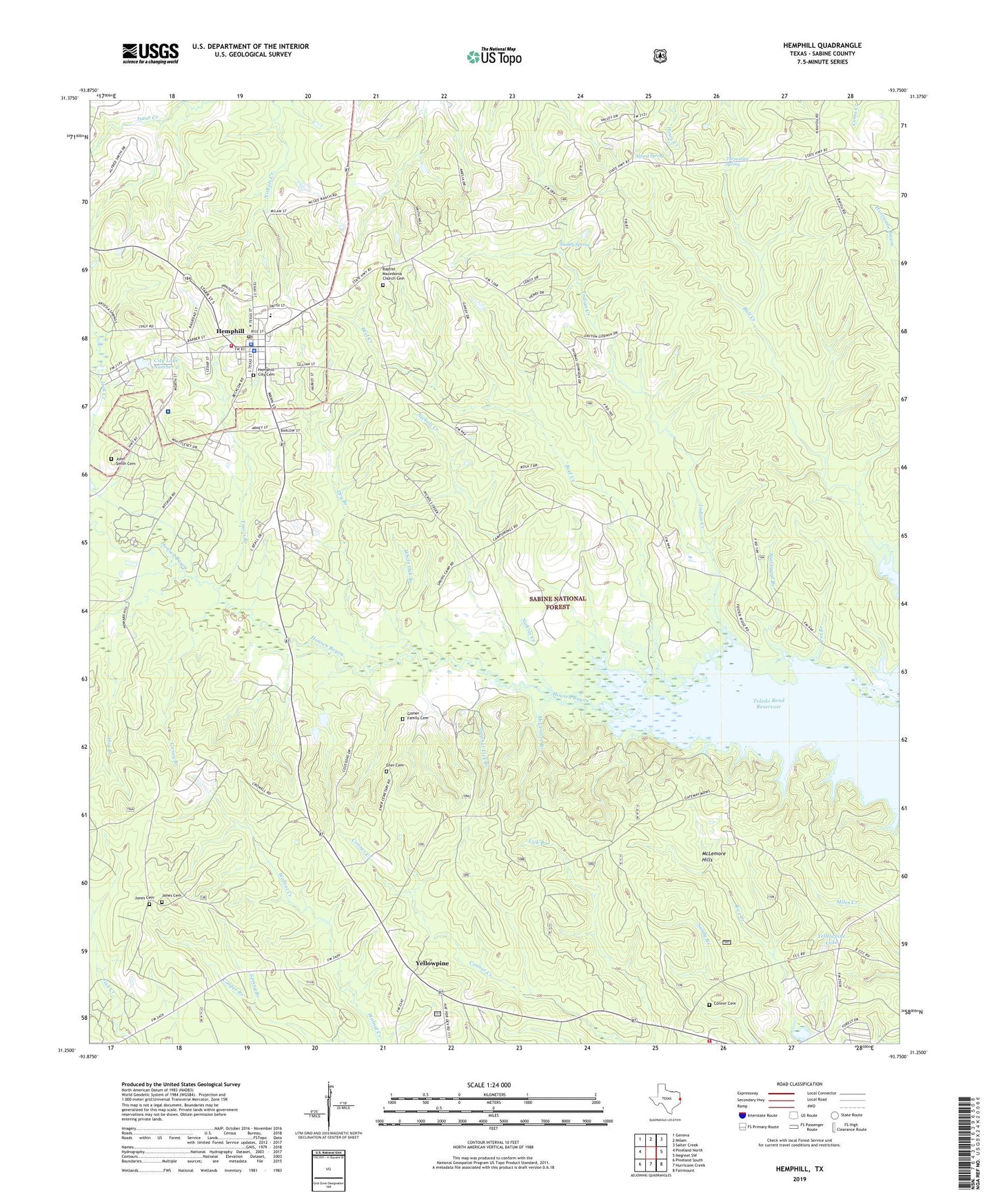
2019 topographic map quadrangle Hemphill in the state of Texas. Scale: 1:24000. Based on the newly updated USGS 7.5' US Topo map series, this map is in the following counties: Sabine. The map contains contour data, water features, and other items you are used to seeing on USGS maps, but also has updated roads and other features. This is the next generation of topographic maps. Printed on high-quality waterproof paper with UV fade-resistant inks.
Quads adjacent to this one:
West: Pineland North
Northwest: Geneva
North: Milam
Northeast: Salter Creek
East: Negreet SW
Southeast: Fairmount
South: Hurricane Creek
Southwest: Pineland South
Contains the following named places: Alford Spring, Baptist Macedonia Church Cemetery, Beef Creek, Camp Springs Church, Caney Branch, City Lake Number 1, City Lake Number 1 Dam, City Lake Number 2, City Lake Number 2 Dam, City of Hemphill, Conner Cemetery, Dry Branch, Ener Cemetery, Gomer Family Cemetery, Hemphill, Hemphill City Cemetery, Hemphill Division, Hemphill Police Department, Hemphill Post Office, Hemphill Volunteer Fire Department, Hog Branch, Indian Creek, John Smith Cemetery, Jones Cemetery, KAWS-AM (Hemphill), Macedonia Baptist Church, Macedonia Missionary Baptist Church, McLemore Branch, McLemore Hills, Nickols Creek, Pot Branch, Sabine County, Sabine County Constable's Office Precinct 1, Sabine County Hospital, Sabine County Jail, Sabine County Sheriff's Office, Six Mile Volunteer Fire Department, Smiley Spring, Spring Branch, Staveyard Branch, Sulphur Lick Branch, Travis Branch, Turpentine Spring, White Oak Branch, Yellowpine, Yellowpine Lake, Yellowpine Lookout, Yellowpine Ranger District Office, Yellowpine Work Center, ZIP Code: 75948