MyTopo
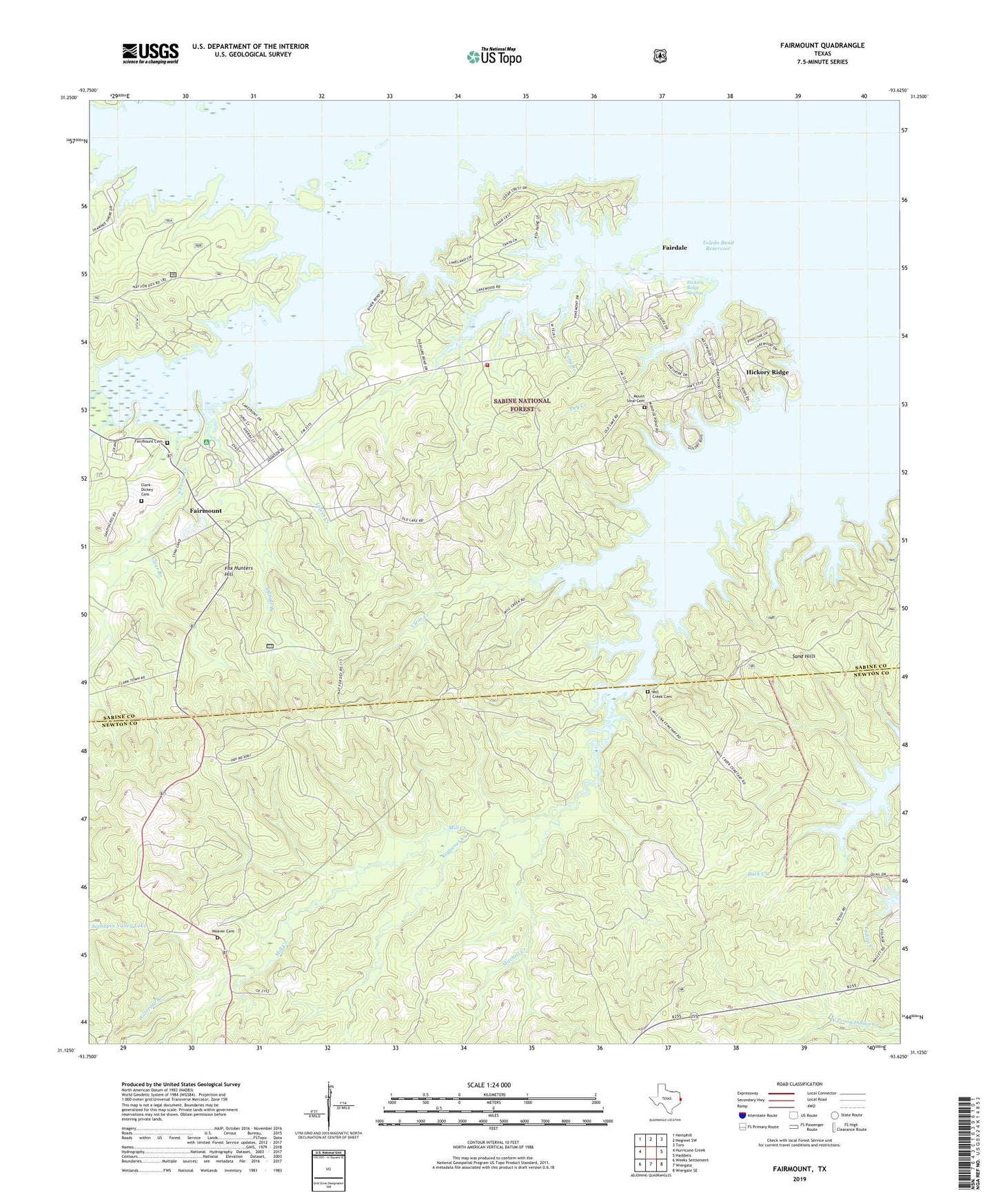
Fairmount Texas US Topo Map
Couldn't load pickup availability
Also explore the Fairmount Forest Service Topo of this same quad for updated USFS data
2022 topographic map quadrangle Fairmount in the state of Texas. Scale: 1:24000. Based on the newly updated USGS 7.5' US Topo map series, this map is in the following counties: Sabine, Newton. The map contains contour data, water features, and other items you are used to seeing on USGS maps, but also has updated roads and other features. This is the next generation of topographic maps. Printed on high-quality waterproof paper with UV fade-resistant inks.
Quads adjacent to this one:
West: Hurricane Creek
Northwest: Hemphill
North: Negreet SW
Northeast: Toro
East: Haddens
Southeast: Wiergate SE
South: Wiergate
Southwest: Weeks Settlement
This map covers the same area as the classic USGS quad with code o31093b6.
Contains the following named places: Big Sandy Creek, Buck Creek, Clark-Dickey Cemetery, Clear Branch, Clear Creek, Copperas Creek, Fairdale, Fairmount, Fairmount Cemetery, Fairmount Volunteer Fire Department, Fox Hunters Hill, Hickory Ridge, Hickory Ridge Springs, Long Branch, Miles Creek, Mill Creek Cemetery, Mitchell Creek, Mount Sinai Cemetery, Sand Hills, Sandy Branch, Shingle Branch, South Prong Creek, Watering Branch, Weaver Cemetery