MyTopo
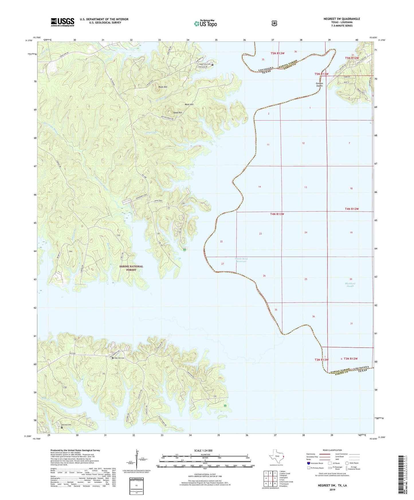
Negreet SW Texas US Topo Map
Couldn't load pickup availability
Also explore the Negreet SW Forest Service Topo of this same quad for updated USFS data
2022 topographic map quadrangle Negreet SW in the states of Texas, Louisiana. Scale: 1:24000. Based on the newly updated USGS 7.5' US Topo map series, this map is in the following counties: Sabine. The map contains contour data, water features, and other items you are used to seeing on USGS maps, but also has updated roads and other features. This is the next generation of topographic maps. Printed on high-quality waterproof paper with UV fade-resistant inks.
Quads adjacent to this one:
West: Hemphill
Northwest: Milam
North: Salter Creek
Northeast: Negreet
East: Toro
Southeast: Haddens
South: Fairmount
Southwest: Hurricane Creek
This map covers the same area as the classic USGS quad with code o31093c6.
Contains the following named places: Arthurs Lake, Ashmore Branch, Bar Lake, Bar Lake School, Big Branch, Black Lake, Blackland Slough, Blackmail Branch, Bull Creek, Columbus, Coma Creek, Crane Pond, Cutoff Lake, Cutoff Pond, Ferry Lake, Godwins Ferry, Gordon Shoals, Green Lake, Grocer Lake, Gum Lake, Gum Slough, Harpers Bend, Hegren Branch, Housen Bayou, Hurricane Bayou, Indian Mounds Wilderness, Isaac Low Cemetery, Lowes Creek, McCartney Lake, McCord Cemetery, Moss Hill, Oak Hill Cemetery, Oak Hill Church, Oil Well Branch, Robertson Ferry, Rock Hill, Sabine Lookout Tower, Saint James Church, Saint Johns Church, Saint Mary Church, Sand Hill, Sixmile Creek, Spate Lake, Tom Self Lake, Willow Pond