MyTopo
Horsehead Canyon Texas US Topo Map
Couldn't load pickup availability
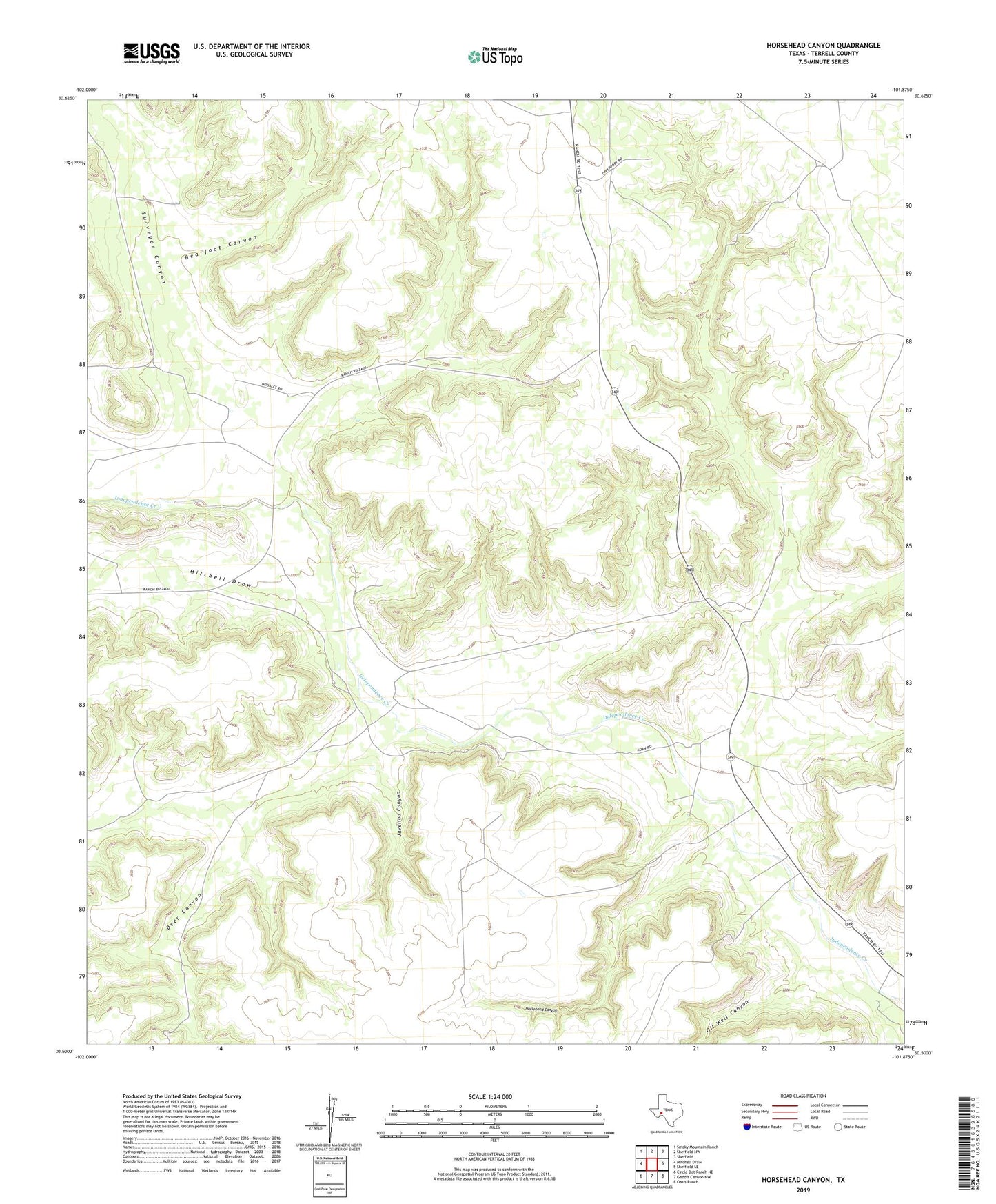
2022 topographic map quadrangle Horsehead Canyon in the state of Texas. Scale: 1:24000. Based on the newly updated USGS 7.5' US Topo map series, this map is in the following counties: Terrell. The map contains contour data, water features, and other items you are used to seeing on USGS maps, but also has updated roads and other features. This is the next generation of topographic maps. Printed on high-quality waterproof paper with UV fade-resistant inks.
Quads adjacent to this one:
West: Mitchell Draw
Northwest: Smoky Mountain Ranch
North: Sheffield NW
Northeast: Sheffield
East: Sheffield SE
Southeast: Oasis Ranch
South: Geddis Canyon NW
Southwest: Circle Dot Ranch NE
This map covers the same area as the classic USGS quad with code o30101e8.
Contains the following named places: Bearfoot Canyon, Deer Canyon, Horsehead Canyon, Javelina Canyon, Mitchell Draw, Oil Well Canyon, Surveyor Canyon