MyTopo
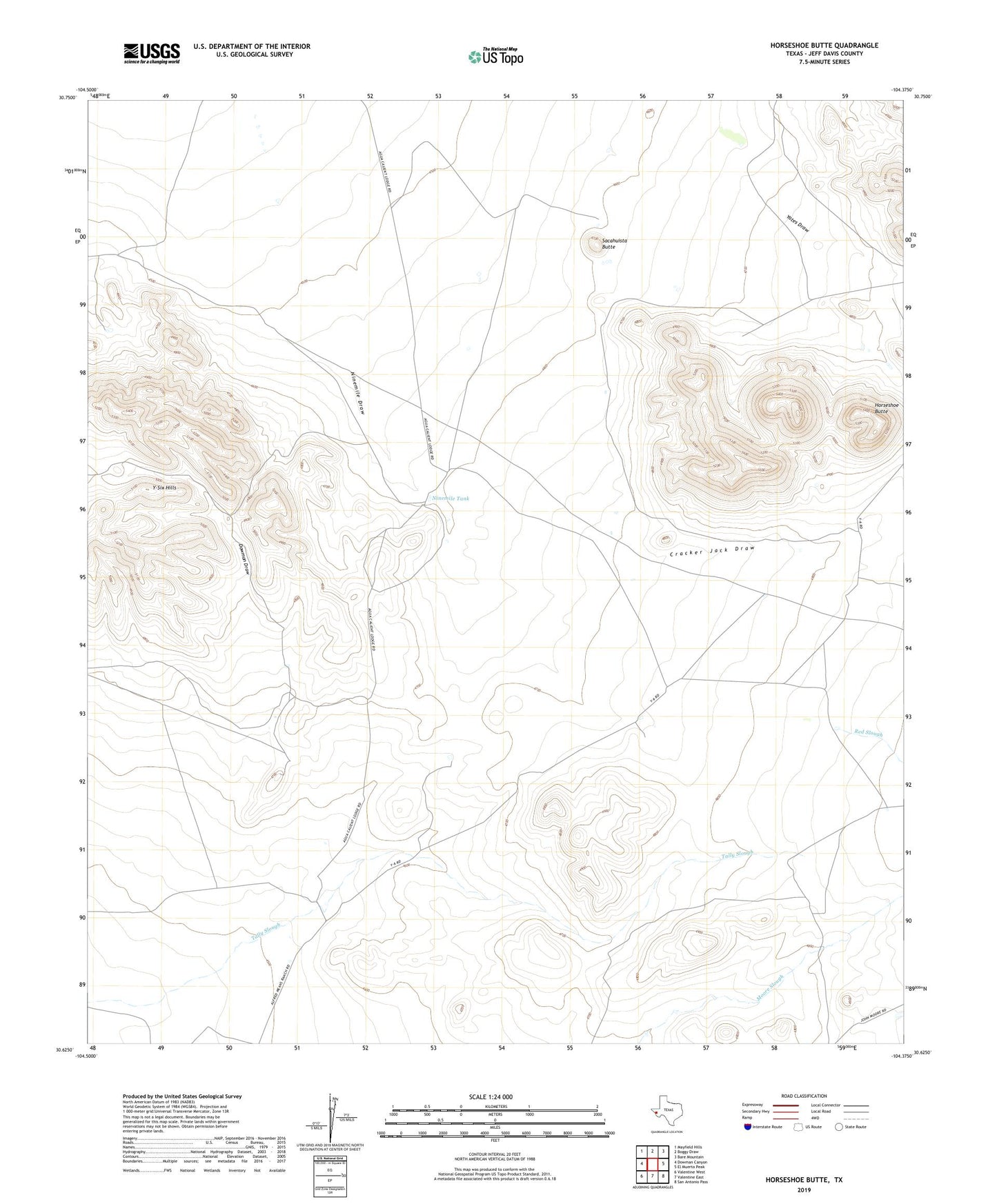
Horseshoe Butte Texas US Topo Map
Couldn't load pickup availability
2022 topographic map quadrangle Horseshoe Butte in the state of Texas. Scale: 1:24000. Based on the newly updated USGS 7.5' US Topo map series, this map is in the following counties: Jeff Davis. The map contains contour data, water features, and other items you are used to seeing on USGS maps, but also has updated roads and other features. This is the next generation of topographic maps. Printed on high-quality waterproof paper with UV fade-resistant inks.
Quads adjacent to this one:
West: Dowman Canyon
Northwest: Mayfield Hills
North: Boggy Draw
Northeast: Bare Mountain
East: El Muerto Peak
Southeast: San Antonio Pass
South: Valentine East
Southwest: Valentine West
This map covers the same area as the classic USGS quad with code o30104f4.
Contains the following named places: Antelope Windmill, Butterfield Windmill, Cracker Jack Draw, Dowman Draw, Hereford Windmill, Horseshoe Butte, Means Ranch, Ninemile Tank, Red Slough, Rito Windmill, Sacahuista Butte, Sacahuista Windmill, Valentine Division, Yates Draw