MyTopo
Valentine East Texas US Topo Map
Couldn't load pickup availability
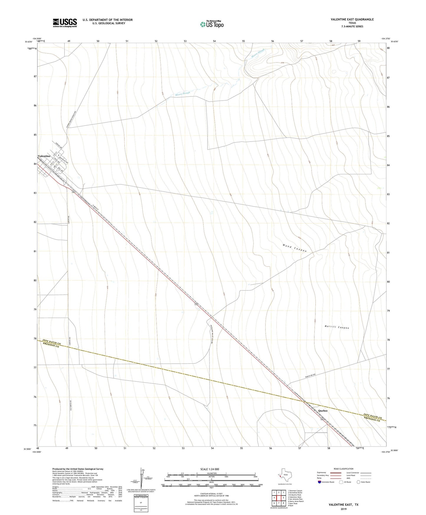
2022 topographic map quadrangle Valentine East in the state of Texas. Scale: 1:24000. Based on the newly updated USGS 7.5' US Topo map series, this map is in the following counties: Jeff Davis, Presidio. The map contains contour data, water features, and other items you are used to seeing on USGS maps, but also has updated roads and other features. This is the next generation of topographic maps. Printed on high-quality waterproof paper with UV fade-resistant inks.
Quads adjacent to this one:
West: Valentine West
Northwest: Dowman Canyon
North: Horseshoe Butte
Northeast: El Muerto Peak
East: San Antonio Pass
Southeast: Ryan
South: Deer Peak
Southwest: Nancy Anne Ranch
This map covers the same area as the classic USGS quad with code o30104e4.
Contains the following named places: Bell Place Windmill, Merrill Canyon, Moore Slough, One Lung Windmill, Quebec, Sacred Heart Cemetery, Town of Valentine, Valentine, Valentine School, Wood Canyon