MyTopo
Christoval Texas US Topo Map
Couldn't load pickup availability
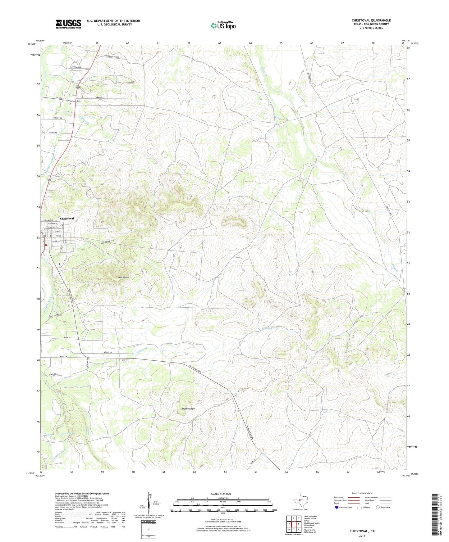
2022 topographic map quadrangle Christoval in the state of Texas. Scale: 1:24000. Based on the newly updated USGS 7.5' US Topo map series, this map is in the following counties: Tom Green. The map contains contour data, water features, and other items you are used to seeing on USGS maps, but also has updated roads and other features. This is the next generation of topographic maps. Printed on high-quality waterproof paper with UV fade-resistant inks.
Quads adjacent to this one:
West: Cold Creek Spring
Northwest: Knickerbocker
North: Pecan Station
Northeast: Wall
East: Susan Peak
Southeast: Christoval SE
South: Cave Spring
Southwest: Hulldale
This map covers the same area as the classic USGS quad with code o31100b4.
Contains the following named places: Anson Spring, Brown Field Airport, Brushy Knob, Christoval, Christoval Census Designated Place, Christoval Post Office, Christoval Volunteer Fire Department, DeLong Cemetery, Dry Creek, McKildrick Draw, Millers Branch, Mountain Susan, South Concho Irrigation Canal, Walnut Creek