MyTopo
East Bernard Texas US Topo Map
Couldn't load pickup availability
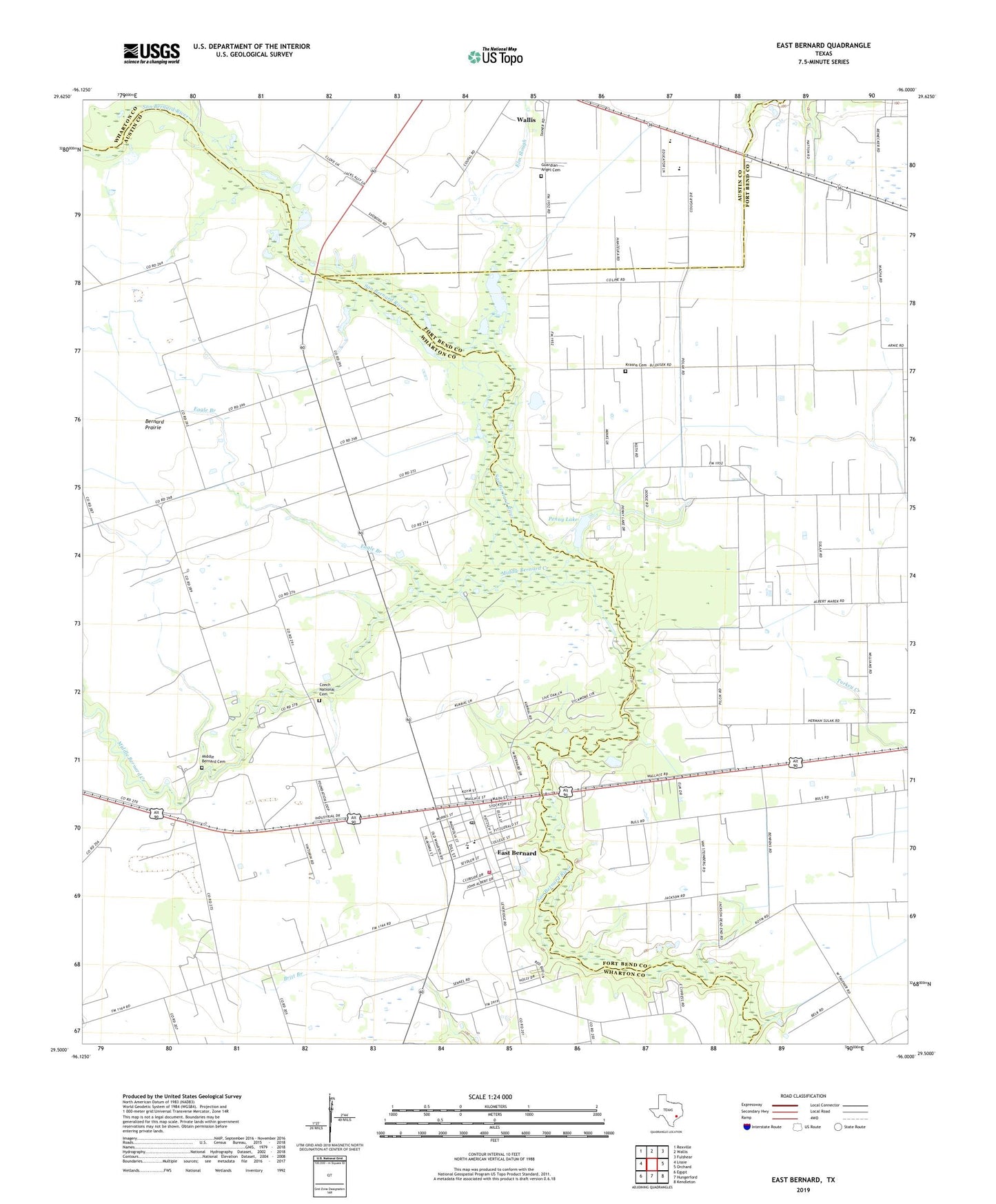
2022 topographic map quadrangle East Bernard in the state of Texas. Scale: 1:24000. Based on the newly updated USGS 7.5' US Topo map series, this map is in the following counties: Wharton, Fort Bend, Austin. The map contains contour data, water features, and other items you are used to seeing on USGS maps, but also has updated roads and other features. This is the next generation of topographic maps. Printed on high-quality waterproof paper with UV fade-resistant inks.
Quads adjacent to this one:
West: Lissie
Northwest: Rexville
North: Wallis
Northeast: Fulshear
East: Orchard
Southeast: Kendleton
South: Hungerford
Southwest: Egypt
This map covers the same area as the classic USGS quad with code o29096e1.
Contains the following named places: Bernard Prairie, Bernard Prairie School, Brazos High School, City of East Bernard, Czech National Cemetery, Eagle Branch, East Bernard, East Bernard City Hall, East Bernard Elementary School, East Bernard Emergency Medical Services, East Bernard High School, East Bernard Junior High School, East Bernard Post Office, East Bernard Volunteer Fire Department, Elm Slough, Guardian Angel Cemetery, Guradian Angel Church, Krasna Cemetery, Middle Bernard Cemetery, Middle Bernard Creek, Penny Lake, Penny Lake Dam, Sweet Coneville Church, Wharton County Constable's Office Precinct 2, ZIP Code: 77435