MyTopo
Huxley Texas US Topo Map
Couldn't load pickup availability
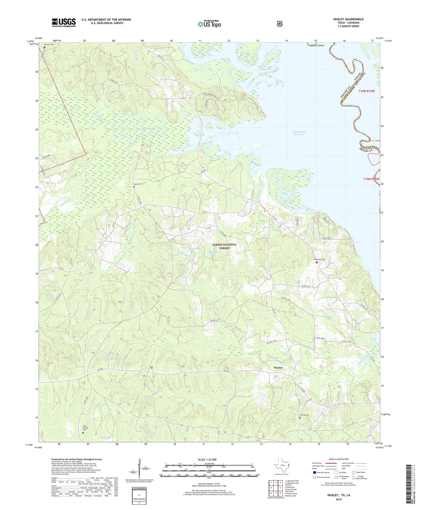
2019 topographic map quadrangle Huxley in the states of Texas, Louisiana. Scale: 1:24000. Based on the newly updated USGS 7.5' US Topo map series, this map is in the following counties: Shelby, De Soto, Sabine. The map contains contour data, water features, and other items you are used to seeing on USGS maps, but also has updated roads and other features. This is the next generation of topographic maps. Printed on high-quality waterproof paper with UV fade-resistant inks.
Quads adjacent to this one:
West: Shelbyville
Northwest: Logansport West
North: Logansport East
Northeast: Hunter
East: Union Springs
Southeast: Brushy Creek
South: Patroon North
Southwest: Hurstown
Contains the following named places: Ashton Cemetery, Boles Field, Brawley Creek, Caney Branch, Carroll Cemetery, Carroll Creek, Carrolltown Church, City of Huxley, Flat Fork Creek, Goodsons Lake, Holly Springs Cemetery, Horseshoe Lake, Huxley, Lydia Church, Mason Lake, National Forest Spring, Old River Lake, Pauls Creek, Pauls Store, Rayborn Church, Strong Cemetery, Tenaha Bayou, Tenaha Creek, Tenaha Lookout Tower, Tuckers Lake, Turkey Creek, Wildcat Bend, Wimberly Cemetery