MyTopo
Hunter Louisiana US Topo Map
Couldn't load pickup availability
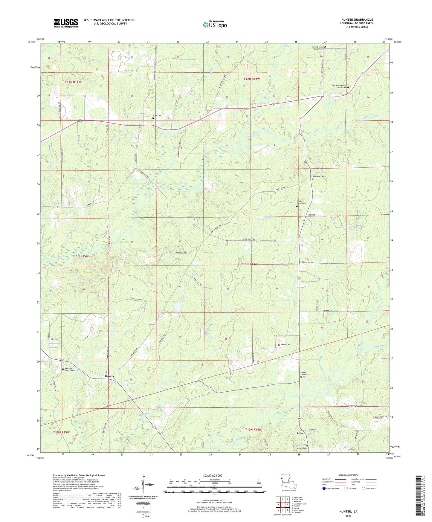
2024 topographic map quadrangle Hunter in the state of Louisiana. Scale: 1:24000. Based on the newly updated USGS 7.5' US Topo map series, this map is in the following counties: De Soto. The map contains contour data, water features, and other items you are used to seeing on USGS maps, but also has updated roads and other features. This is the next generation of topographic maps. Printed on high-quality waterproof paper with UV fade-resistant inks.
Quads adjacent to this one:
West: Logansport East
Northwest: Longstreet
North: Grand Cane
Northeast: Mansfield
East: Trenton
Southeast: Converse
South: Union Springs
Southwest: Huxley
This map covers the same area as the classic USGS quad with code o31093h7.
Contains the following named places: Baget Creek, Barber Cemetery, Beulah Church, Catuna Gas Field, Cook, Cypress Bayou, Duke Bayou, Ebenezer Cemetery, Hunter, Hunter Lookout Tower, Jackson Creek, Lenoir, Lula, Lula Gas Field, Lula School, Magnolia Baptist Church, Morning Glory Church, New Bethany Church, Parish Governing Authority District 1C, Pollard Cemetery, Prude Cemetery, Shady Grove Cemetery, Shady Grove United Methodist Church, Spider, Spider Gas Field, Third Ward School, Ward Three, Williams Creek