MyTopo
Independence Texas US Topo Map
Couldn't load pickup availability
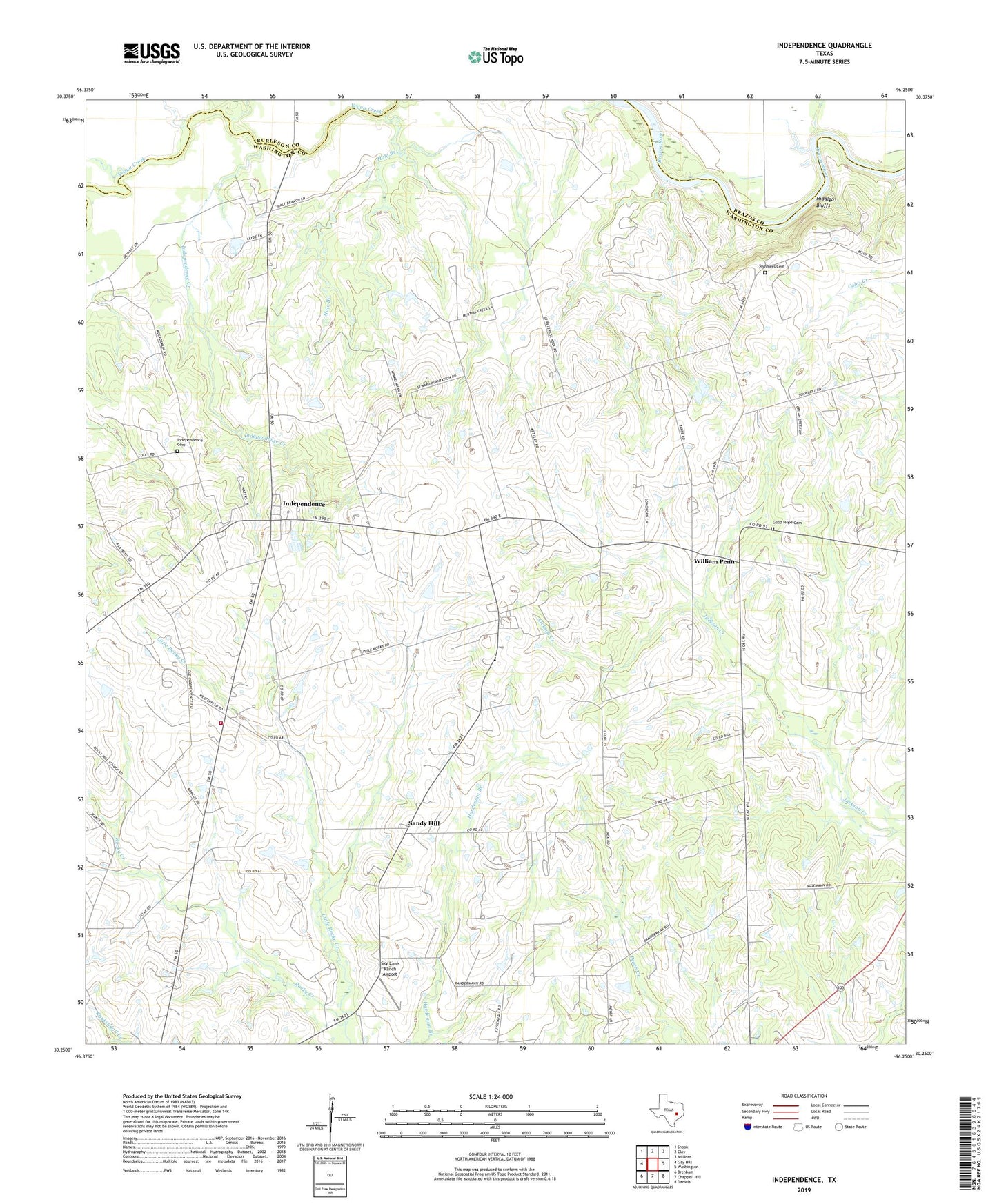
2019 topographic map quadrangle Independence in the state of Texas. Scale: 1:24000. Based on the newly updated USGS 7.5' US Topo map series, this map is in the following counties: Washington, Brazos, Burleson. The map contains contour data, water features, and other items you are used to seeing on USGS maps, but also has updated roads and other features. This is the next generation of topographic maps. Printed on high-quality waterproof paper with UV fade-resistant inks.
Quads adjacent to this one:
West: Gay Hill
Northwest: Snook
North: Clay
Northeast: Millican
East: Washington
Southeast: Daniels
South: Chappell Hill
Southwest: Brenham
Contains the following named places: Asa Hoxey House, Baylor University State Park, Bethlehem Church, Faust Farm Airport, Flying C Ranch Airport, Fritz Paul and Emma Schroeder House, General J B Robertson Home, General Sam Houston Home, Good Hope Cemetery, Hale Branch, Independence, Independence Cemetery, Independence Creek, John Laura Seward Home, Little Rocky Creek, Mrs Sam Houston House, Palestine School, Prairie Hill - Rocky Hill Volunteer Fire Department, Prairie Hill Community Hall, Reue-Eickenhorst House, Saint Matthew Church, Saint Peter School, Sandy Hill, Sky Lane Ranch Airport, Summers Cemetery, Union Hill Church, William Penn, William Penn School