MyTopo
Daniels Texas US Topo Map
Couldn't load pickup availability
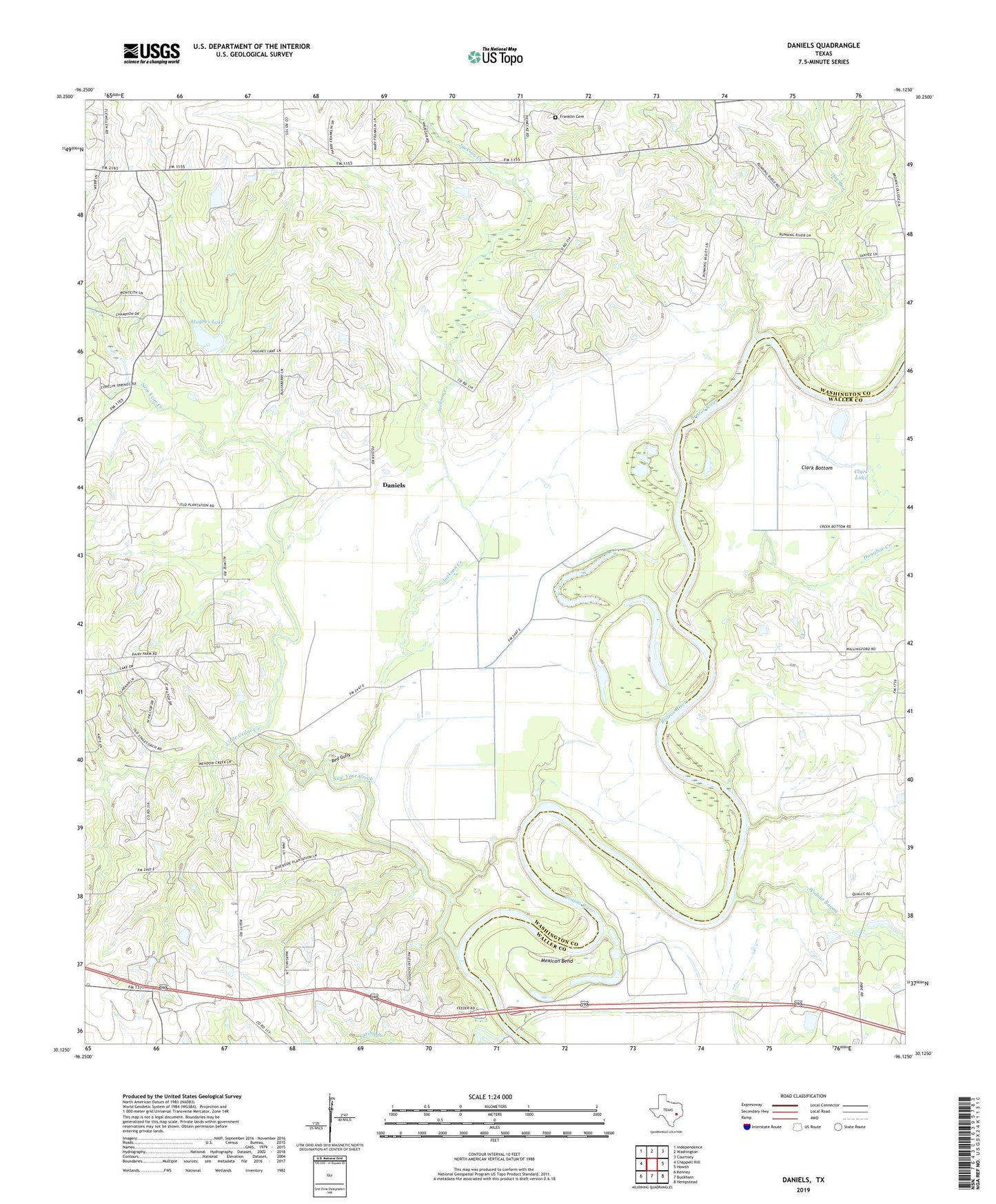
2022 topographic map quadrangle Daniels in the state of Texas. Scale: 1:24000. Based on the newly updated USGS 7.5' US Topo map series, this map is in the following counties: Washington, Waller. The map contains contour data, water features, and other items you are used to seeing on USGS maps, but also has updated roads and other features. This is the next generation of topographic maps. Printed on high-quality waterproof paper with UV fade-resistant inks.
Quads adjacent to this one:
West: Chappell Hill
Northwest: Independence
North: Washington
Northeast: Courtney
East: Howth
Southeast: Hempstead
South: Buckhorn
Southwest: Kenney
This map covers the same area as the classic USGS quad with code o30096b2.
Contains the following named places: Anderson Cemetery, Brown College, Clark Lake, Daniels, Doe Run, Donahoe Creek, Franklin Cemetery, Goodwill, Hughes Lake, Hughes Lake Dam, Jackson Creek, Lake Number 3, Lake Number 3 Dam, Little Cedar Creek, Mexican Bend, Mount Calvary Church, New Year Creek, Paul Felder Church, Peach Creek, Red Gully, Rock Island, Rocking W Ranch Heliport, Routt Hill Church, Walnut Bayou, Washington-Chappell Hill Division, Whitman