MyTopo
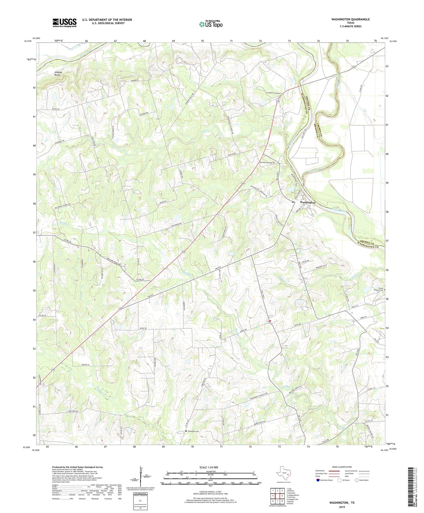
Washington Texas US Topo Map
Couldn't load pickup availability
2022 topographic map quadrangle Washington in the state of Texas. Scale: 1:24000. Based on the newly updated USGS 7.5' US Topo map series, this map is in the following counties: Washington, Grimes, Brazos. The map contains contour data, water features, and other items you are used to seeing on USGS maps, but also has updated roads and other features. This is the next generation of topographic maps. Printed on high-quality waterproof paper with UV fade-resistant inks.
Quads adjacent to this one:
West: Independence
Northwest: Clay
North: Millican
Northeast: Navasota
East: Courtney
Southeast: Howth
South: Daniels
Southwest: Chappell Hill
This map covers the same area as the classic USGS quad with code o30096c2.
Contains the following named places: Anson Jones Home, Antioch Church, Coles Creek, Friedens Church, Graball, Hatfield Plantation, Hidalgo Bluffs, John M Brown House, Jordan Creek, Mount Zion Church, Mount Zion School, Navasota River, Sacred Heart Church, Saint Matthew Church, Saint Matthew School, Sand Branch, Star of the Republic Museum, Tennyson Cemetery, Washington, Washington - on - the - Brazos State Historic Site Trail, Washington Post Office, Washington School, Washington State Park, Washington Volunteer Fire Department, Washington-on-the-Brazos State Historical Park, ZIP Code: 77880