MyTopo
Indian Gap Texas US Topo Map
Couldn't load pickup availability
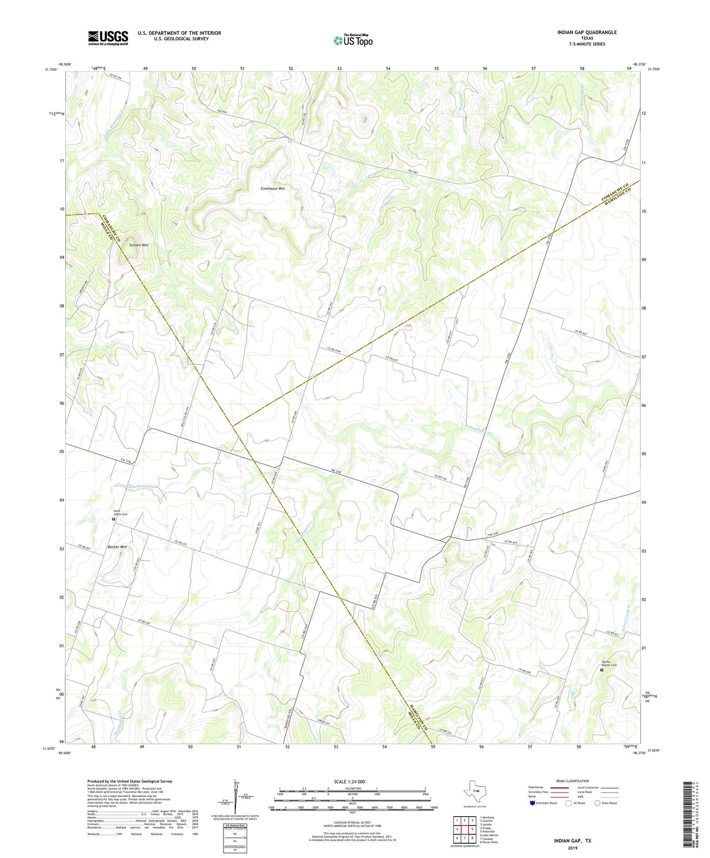
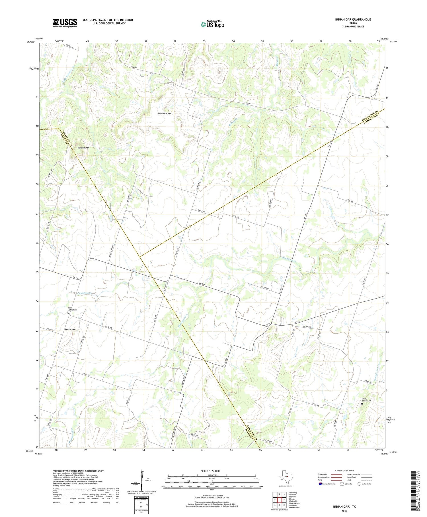
2019 topographic map quadrangle Indian Gap in the state of Texas. Scale: 1:24000. Based on the newly updated USGS 7.5' US Topo map series, this map is in the following counties: Hamilton, Comanche, Mills. The map contains contour data, water features, and other items you are used to seeing on USGS maps, but also has updated roads and other features. This is the next generation of topographic maps. Printed on high-quality waterproof paper with UV fade-resistant inks.
Quads adjacent to this one:
West: Priddy
Northwest: Newburg
North: Gustine
Northeast: Lamkin
East: Pottsville
Southeast: Pecan Wells
South: Caradan
Southwest: Lake Merritt
Contains the following named places: Becker Mountain, Cowhouse Mountain, Indian Gap, Pottsville Gas Field, Saint Johns Cemetery, Schoen Mountain, Spivey-Baxter Cemetery, Washboard Creek