MyTopo
Caradan Texas US Topo Map
Couldn't load pickup availability
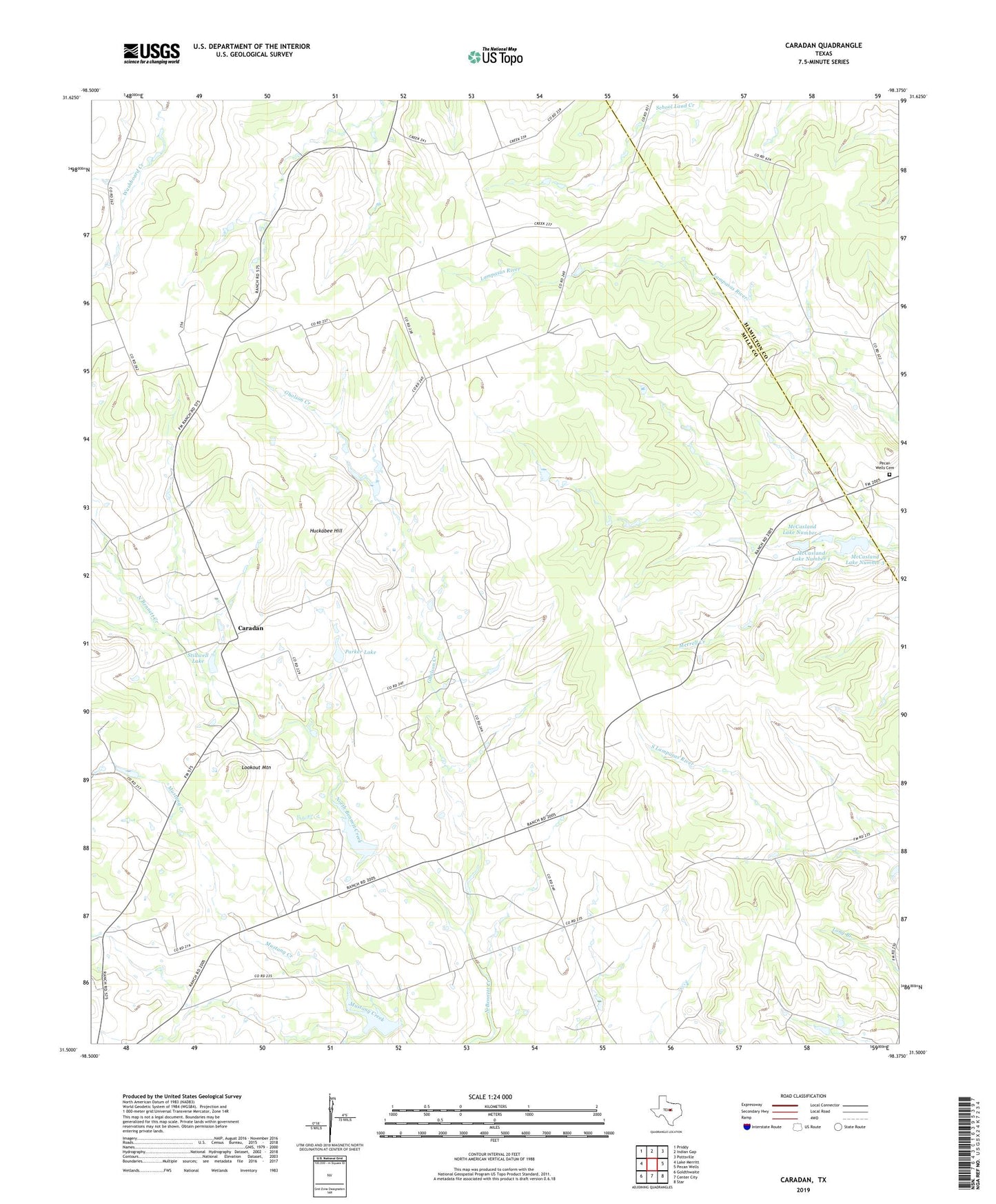
2022 topographic map quadrangle Caradan in the state of Texas. Scale: 1:24000. Based on the newly updated USGS 7.5' US Topo map series, this map is in the following counties: Mills, Hamilton. The map contains contour data, water features, and other items you are used to seeing on USGS maps, but also has updated roads and other features. This is the next generation of topographic maps. Printed on high-quality waterproof paper with UV fade-resistant inks.
Quads adjacent to this one:
West: Lake Merritt
Northwest: Priddy
North: Indian Gap
Northeast: Pottsville
East: Pecan Wells
Southeast: Star
South: Center City
Southwest: Goldthwaite
This map covers the same area as the classic USGS quad with code o31098e4.
Contains the following named places: Bethel Church, Caradan, Gholson Creek, Graves Lake, Graves Lake Dam, Huckabee Hill, Lookout Mountain, McCasland Lake Number 1, McCasland Lake Number 1 Dam, McCasland Lake Number 2, McCasland Lake Number 2 Dam, McCasland Lake Number 3, McCasland Lake Number 3 Dam, Midway School, Mount Olive Church, North Bennett Church, Parker Lake, Parker Lake Dam, Pecan Wells Cemetery, Soil Conservation Service Site 3 Dam, Soil Conservation Service Site 3 Reservoir, Soil Conservation Service Site 4 Dam, Soil Conservation Service Site 4 Reservoir, Stillwell Lake, Stillwell Lake Dam