MyTopo
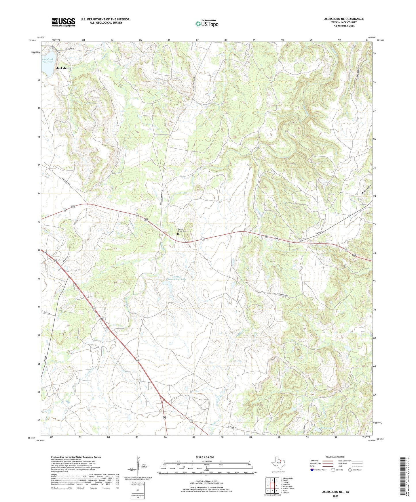
Jacksboro NE Texas US Topo Map
Couldn't load pickup availability
2019 topographic map quadrangle Jacksboro NE in the state of Texas. Scale: 1:24000. Based on the newly updated USGS 7.5' US Topo map series, this map is in the following counties: Jack. The map contains contour data, water features, and other items you are used to seeing on USGS maps, but also has updated roads and other features. This is the next generation of topographic maps. Printed on high-quality waterproof paper with UV fade-resistant inks.
Quads adjacent to this one:
West: Jacksboro
Northwest: Johnson Lake
North: Cundiff
Northeast: Crafton
East: Wizard Wells
Southeast: Gibtown
South: Perrin
Southwest: Bartons Chapel
Contains the following named places: Annin Lake, Annin Lake Dam, Carroll Creek Cemetery, Crooked Hollow, Lilly Roadside Park, Rusmag Oil Field, Snake Creek, Thomas Cherryhomes Lake, Thomas Cherryhomes Lake Dam