MyTopo
Wizard Wells Texas US Topo Map
Couldn't load pickup availability
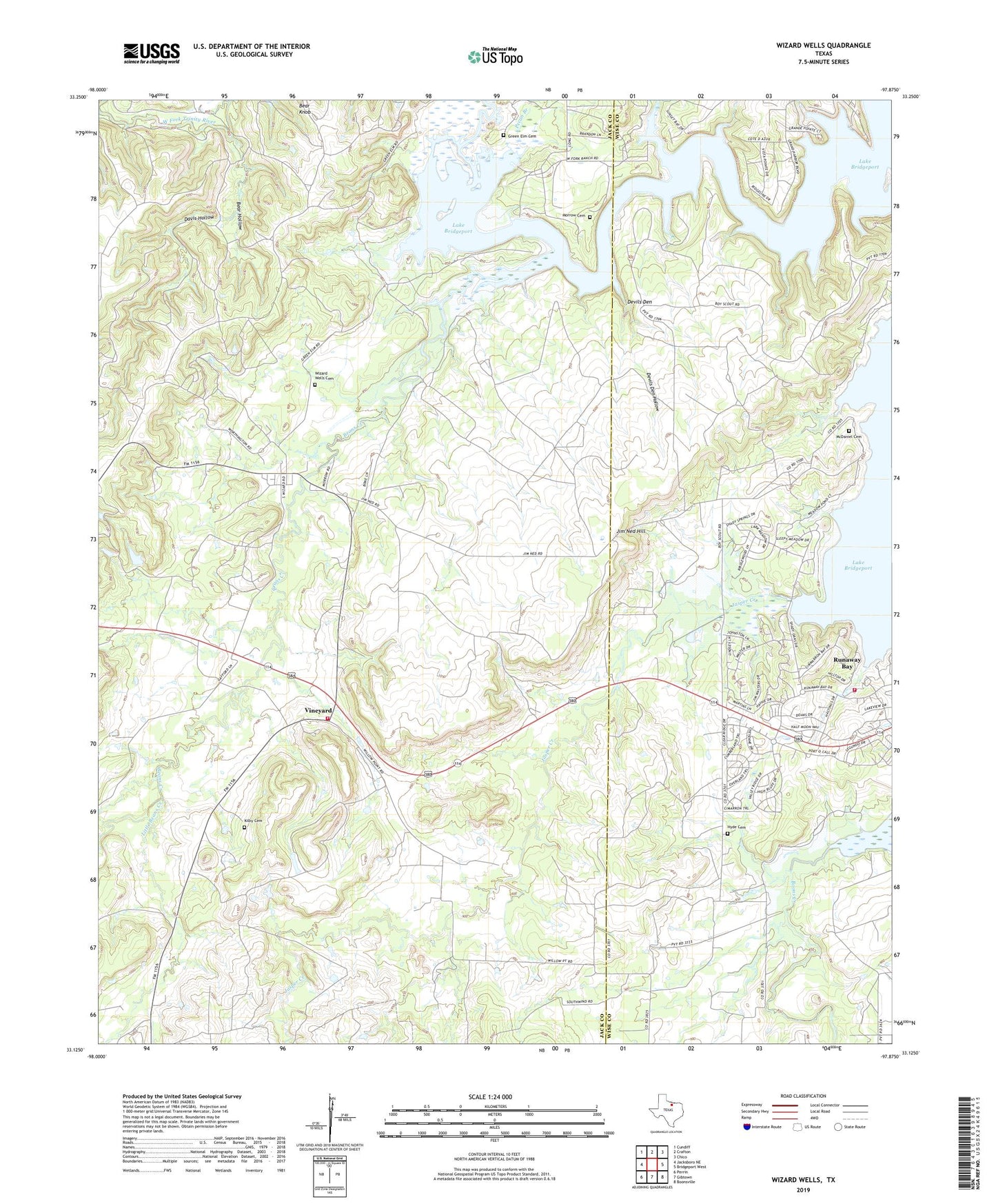
2022 topographic map quadrangle Wizard Wells in the state of Texas. Scale: 1:24000. Based on the newly updated USGS 7.5' US Topo map series, this map is in the following counties: Jack, Wise. The map contains contour data, water features, and other items you are used to seeing on USGS maps, but also has updated roads and other features. This is the next generation of topographic maps. Printed on high-quality waterproof paper with UV fade-resistant inks.
Quads adjacent to this one:
West: Jacksboro NE
Northwest: Cundiff
North: Crafton
Northeast: Chico
East: Bridgeport West
Southeast: Boonsville
South: Gibtown
Southwest: Perrin
This map covers the same area as the classic USGS quad with code o33097b8.
Contains the following named places: Beans Creek, Bear Hollow, Boons Creek, Davis Hollow, Devils Den, Devils Den Hollow, East Jack County Rural Volunteer Fire Department, First Baptist Church, Green Elm Cemetery, Hyde Cemetery, Jasper Creek, Jim Ned Hill, Kilby Cemetery, Little Beans Creek, McDaniel Cemetery, Morrow Cemetery, Pecan Branch, Runaway Bay, Steele Island, Vineyard, Wizard Wells, Wizard Wells Cemetery