MyTopo
Jacksboro Texas US Topo Map
Couldn't load pickup availability
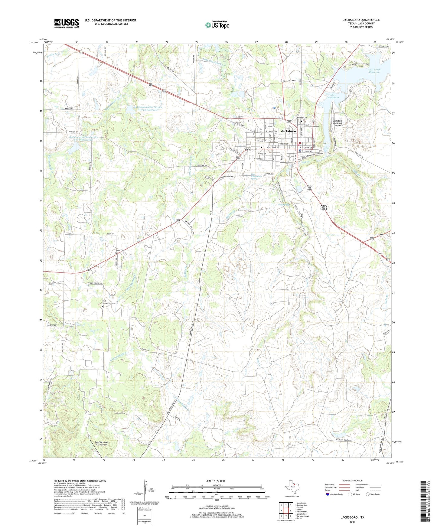
2022 topographic map quadrangle Jacksboro in the state of Texas. Scale: 1:24000. Based on the newly updated USGS 7.5' US Topo map series, this map is in the following counties: Jack. The map contains contour data, water features, and other items you are used to seeing on USGS maps, but also has updated roads and other features. This is the next generation of topographic maps. Printed on high-quality waterproof paper with UV fade-resistant inks.
Quads adjacent to this one:
West: Senate
Northwest: Lynn Creek
North: Johnson Lake
Northeast: Cundiff
East: Jacksboro NE
Southeast: Perrin
South: Bartons Chapel
Southwest: Long Hollow
This map covers the same area as the classic USGS quad with code o33098b2.
Contains the following named places: Bibleway Chapel, City of Jacksboro, College Hill, Dark Corner Cemetery, Faith Community Hospital, Fort Richardson, Fort Richardson Spring, Fort Richardson State Historical Park, Fort Richardson State Historical Park Trail, Halls Branch, Jack County, Jack County Constable's Office, Jack County Jail, Jack County Rural Fire Department, Jack County Sheriff's Office, Jacksboro, Jacksboro Alternative School, Jacksboro City Hall, Jacksboro Elementary School, Jacksboro High School, Jacksboro Municipal Airport, Jacksboro Police Department, Jacksboro Post Office, Jacksboro Volunteer Fire Department, James W Knox House, John Lowrance Middle School, Lake Jacksboro, Lake Jacksboro Dam, Linnie Shelton School, Lost Creek Reservoir, Oakwood Cemetery, One Sixty Four Place Airport, Park Spring, Raper Cemetery, Soil Conservation Service Site 19 Dam, Soil Conservation Service Site 19 Reservoir, Soil Conservation Service Site 20 Dam, Soil Conservation Service Site 20 Reservoir, Southwest Baptist Church, Spillers Branch, Steed Oil Field, Texas Department of Criminal Justice John R Lindsey State Jail, Tiger Stadium, ZIP Code: 76458