MyTopo
Perrin Texas US Topo Map
Couldn't load pickup availability
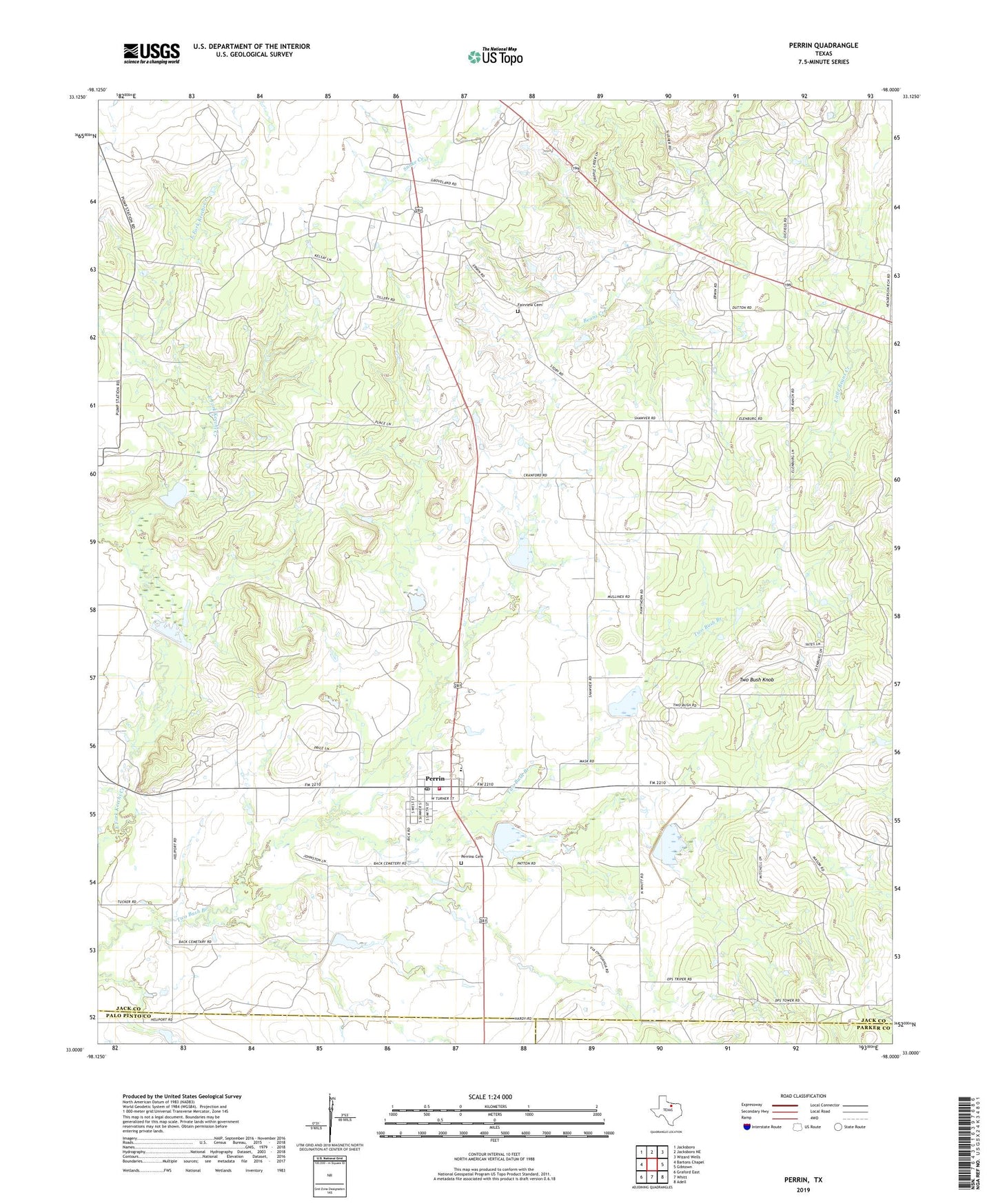
2022 topographic map quadrangle Perrin in the state of Texas. Scale: 1:24000. Based on the newly updated USGS 7.5' US Topo map series, this map is in the following counties: Jack, Palo Pinto, Parker. The map contains contour data, water features, and other items you are used to seeing on USGS maps, but also has updated roads and other features. This is the next generation of topographic maps. Printed on high-quality waterproof paper with UV fade-resistant inks.
Quads adjacent to this one:
West: Bartons Chapel
Northwest: Jacksboro
North: Jacksboro NE
Northeast: Wizard Wells
East: Gibtown
Southeast: Adell
South: Whitt
Southwest: Graford East
This map covers the same area as the classic USGS quad with code o33098a1.
Contains the following named places: Fairview Cemetery, Perrin, Perrin Census Designated Place, Perrin Division, Perrin Post Office, Perrin Volunteer Fire Department, Perrino Cemetery, Soil Conservation Service Site 1 Dam, Soil Conservation Service Site 1 Reservoir, Soil Conservation Service Site 10 Dam, Soil Conservation Service Site 10 Reservoir, Soil Conservation Service Site 3 Dam, Soil Conservation Service Site 3 Reservoir, Soil Conservation Service Site 4 Dam, Soil Conservation Service Site 4 Reservoir, Soil Conservation Service Site 5 Dam, Soil Conservation Service Site 5 Reservoir, Soil Conservation Service Site 6 Dam, Soil Conservation Service Site 6 Reservoir, Soil Conservation Service Site 7 Dam, Soil Conservation Service Site 7 Reservoir, Soil Conservation Service Site 9 Dam, Soil Conservation Service Site 9 Reservoir, Two Bush Knob, ZIP Code: 76486