MyTopo
Johnnie Little Hill Texas US Topo Map
Couldn't load pickup availability
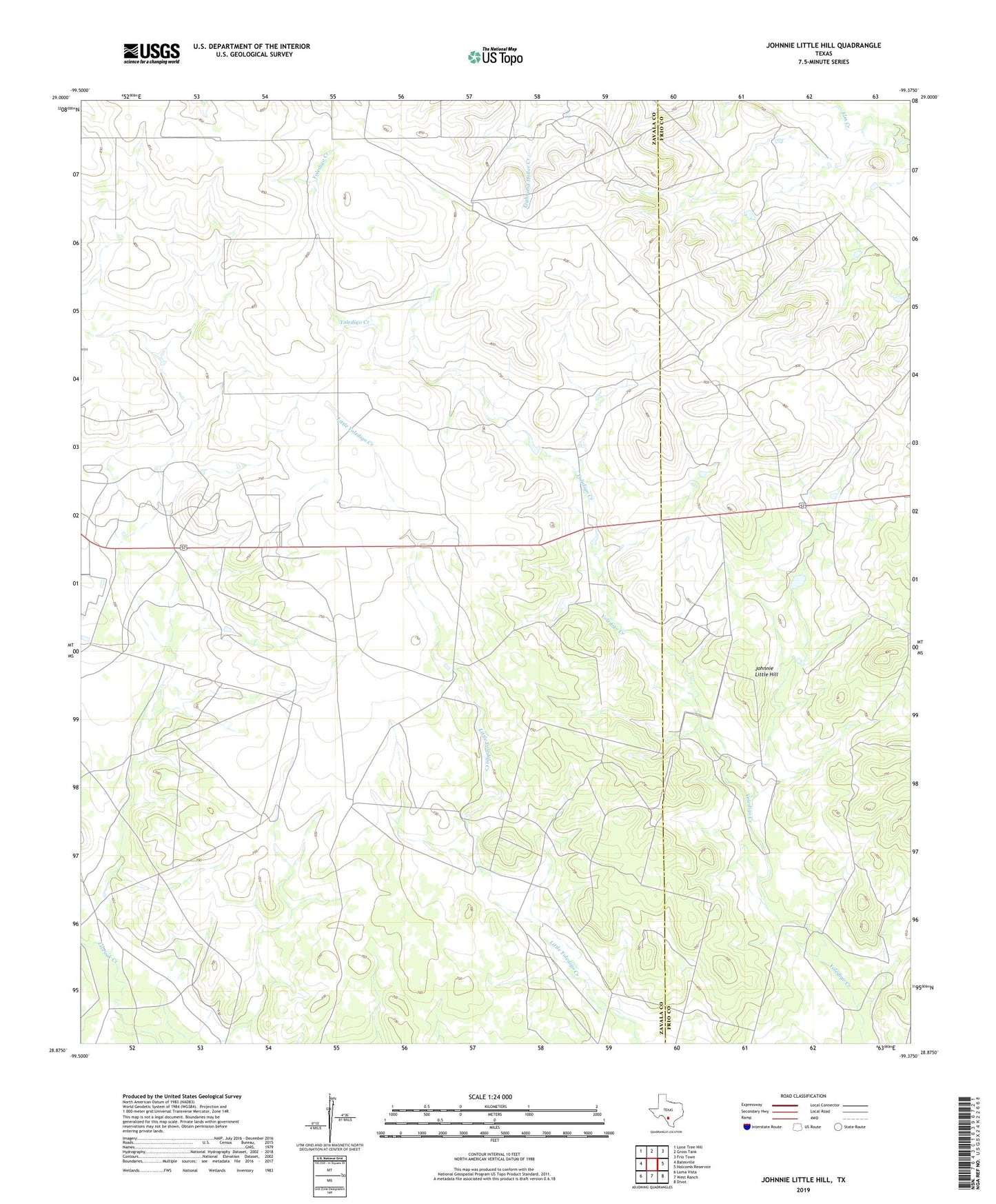
2019 topographic map quadrangle Johnnie Little Hill in the state of Texas. Scale: 1:24000. Based on the newly updated USGS 7.5' US Topo map series, this map is in the following counties: Zavala, Frio. The map contains contour data, water features, and other items you are used to seeing on USGS maps, but also has updated roads and other features. This is the next generation of topographic maps. Printed on high-quality waterproof paper with UV fade-resistant inks.
Quads adjacent to this one:
West: Batesville
Northwest: Lone Tree Hill
North: Gross Tank
Northeast: Frio Town
East: Holcomb Reservoir
Southeast: Divot
South: West Ranch
Southwest: Loma Vista
Contains the following named places: Johnnie Little Hill, Mare Trap Windmill, Nash Ranch Airport, North Windmill, Three Leg Windmill, Timber Lake Windmill, Windmill Number Eight, Windmill Number Nine, Windmill Number Seven