MyTopo
Batesville Texas US Topo Map
Couldn't load pickup availability
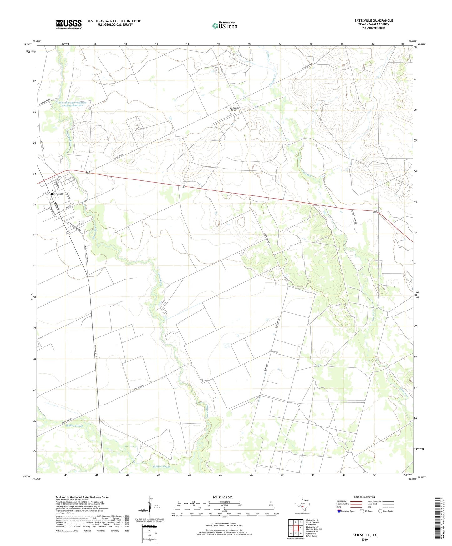
2022 topographic map quadrangle Batesville in the state of Texas. Scale: 1:24000. Based on the newly updated USGS 7.5' US Topo map series, this map is in the following counties: Zavala. The map contains contour data, water features, and other items you are used to seeing on USGS maps, but also has updated roads and other features. This is the next generation of topographic maps. Printed on high-quality waterproof paper with UV fade-resistant inks.
Quads adjacent to this one:
West: Batesville NW
Northwest: Batesville Hill
North: Lone Tree Hill
Northeast: Gross Tank
East: Johnnie Little Hill
Southeast: West Ranch
South: Loma Vista
Southwest: Batesville SW
This map covers the same area as the classic USGS quad with code o28099h5.
Contains the following named places: Batesville, Batesville Census Designated Place, Batesville Division, Batesville Post Office, DM Ranch Airport, Elm Creek, Old Comanche Irrigation Company Dam, Old Comanche Irrigation Company Reservoir, ZIP Code: 78829