MyTopo
Holcomb Reservoir Texas US Topo Map
Couldn't load pickup availability
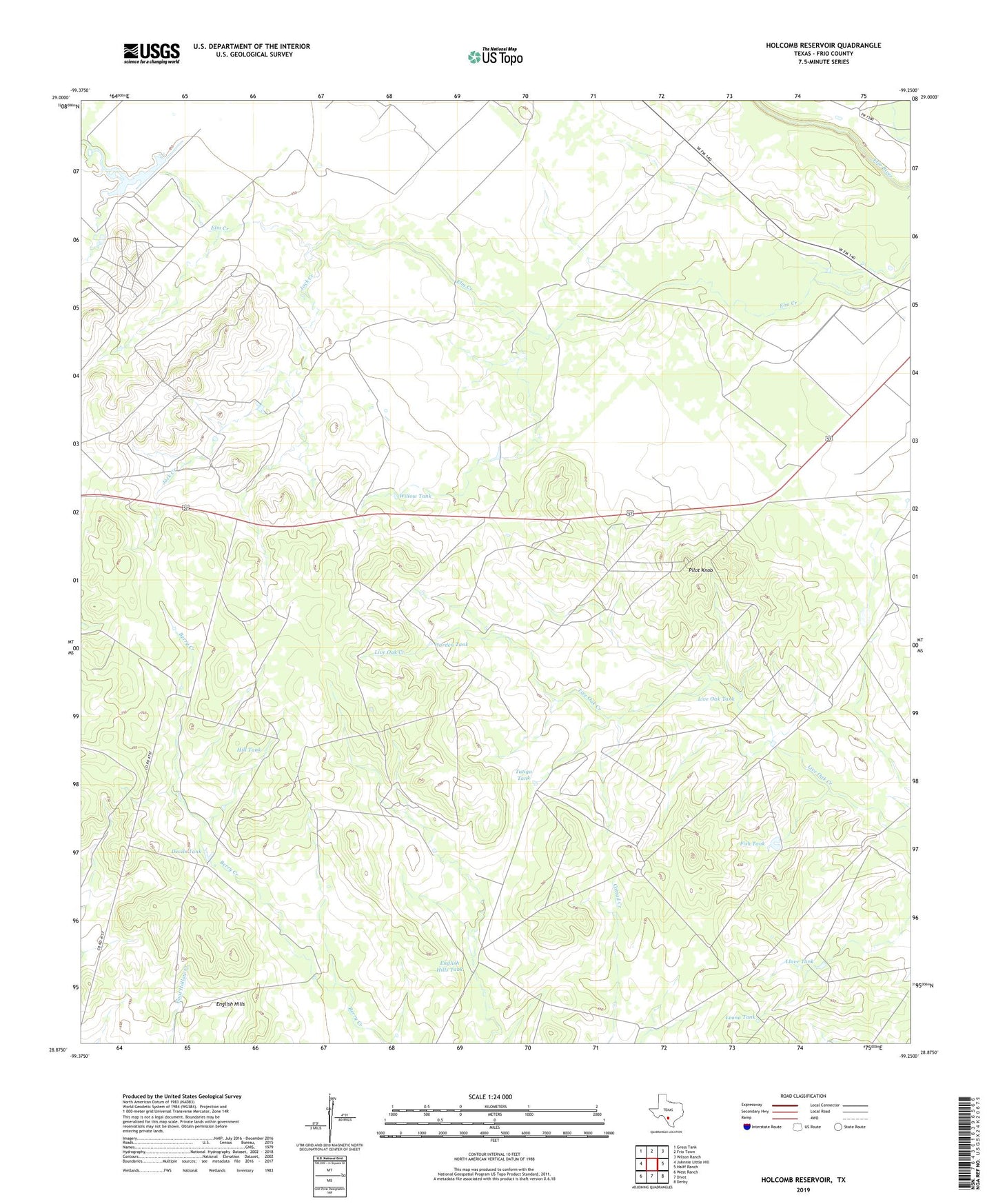
2022 topographic map quadrangle Holcomb Reservoir in the state of Texas. Scale: 1:24000. Based on the newly updated USGS 7.5' US Topo map series, this map is in the following counties: Frio. The map contains contour data, water features, and other items you are used to seeing on USGS maps, but also has updated roads and other features. This is the next generation of topographic maps. Printed on high-quality waterproof paper with UV fade-resistant inks.
Quads adjacent to this one:
West: Johnnie Little Hill
Northwest: Gross Tank
North: Frio Town
Northeast: Wilson Ranch
East: Halff Ranch
Southeast: Derby
South: Divot
Southwest: West Ranch
This map covers the same area as the classic USGS quad with code o28099h3.
Contains the following named places: Devils Tank, English Hills, English Hills Tank, Fish Tank, Garden Tank, Hill Tank, Holcomb Reservoir, Holcomb Reservoir Dam, Jack Creek, Leona Tank, Live Oak Tank, Llave Tank, Pilot Knob, Tutiga Tank, Willow Tank