MyTopo
Loma Vista Texas US Topo Map
Couldn't load pickup availability
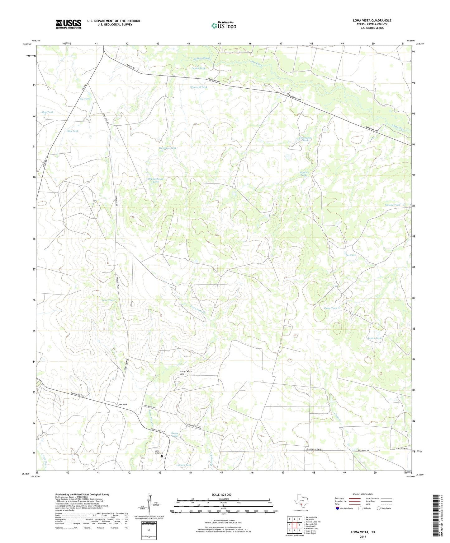
2022 topographic map quadrangle Loma Vista in the state of Texas. Scale: 1:24000. Based on the newly updated USGS 7.5' US Topo map series, this map is in the following counties: Zavala. The map contains contour data, water features, and other items you are used to seeing on USGS maps, but also has updated roads and other features. This is the next generation of topographic maps. Printed on high-quality waterproof paper with UV fade-resistant inks.
Quads adjacent to this one:
West: Batesville SW
Northwest: Batesville NW
North: Batesville
Northeast: Johnnie Little Hill
East: West Ranch
Southeast: Snake Creek
South: Sugar Creek
Southwest: Woodard Lake
This map covers the same area as the classic USGS quad with code o28099g5.
Contains the following named places: Big Tank, Carmichael Tank, Carrizo Well, Clay Tank, Coma Tank, Gallina Slough, House Tank, Lagua Tank, Leona Tank, Loma Vista, Loma Vista Cemetery, Loma Vista Hill, Middle Tank, Old Zachman Tank, Pet Tank, Ship Tank, Simona Tank, South Tank, Taquache Tank, Twin Tank, White Cotton Ranch, Windmill Tank