MyTopo
Johnsville Texas US Topo Map
Couldn't load pickup availability
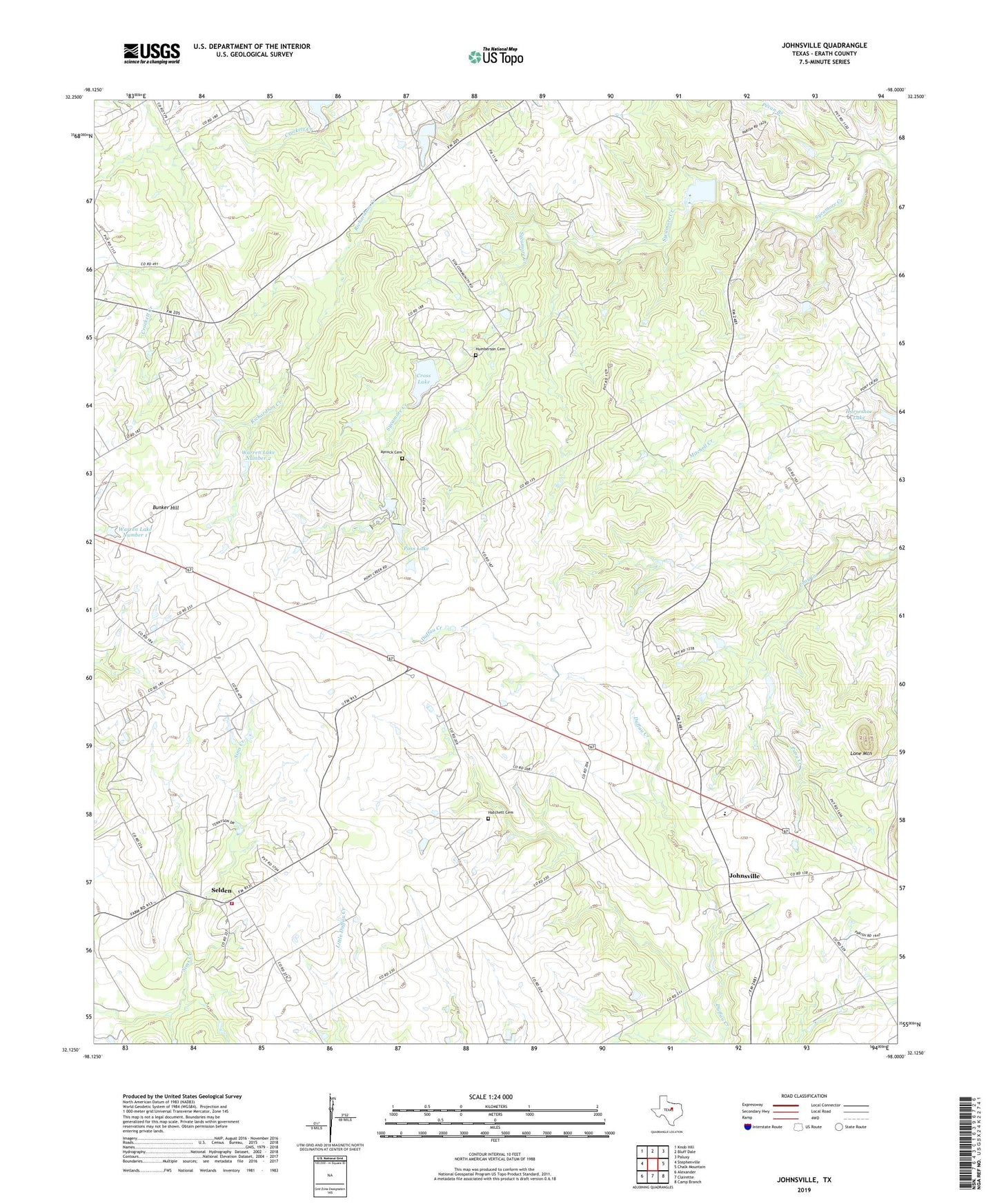
2019 topographic map quadrangle Johnsville in the state of Texas. Scale: 1:24000. Based on the newly updated USGS 7.5' US Topo map series, this map is in the following counties: Erath. The map contains contour data, water features, and other items you are used to seeing on USGS maps, but also has updated roads and other features. This is the next generation of topographic maps. Printed on high-quality waterproof paper with UV fade-resistant inks.
Quads adjacent to this one:
West: Stephenville
Northwest: Knob Hill
North: Bluff Dale
Northeast: Paluxy
East: Chalk Mountain
Southeast: Camp Branch
South: Clairette
Southwest: Alexander
Contains the following named places: Aycock Cemetery, Bunker Hill, Cross Lake, Gross Dam, Hatchett Cemetery, Humberson Cemetery, Johnsville, Lone Mountain, Mitchell Creek Church, Pass Lake, Pass Lake Dam, Pecan Branch, Pony Creek Cemetery, Pony Creek Church, Selden, Selden Volunteer Fire Department, Three Way, Warren Lake Number 1, Warren Lake Number 1 Dam, Warren Lake Number 2, Warren Lake Number 2 Dam