
MyTopo
Juliff Texas US Topo Map
Couldn't load pickup availability
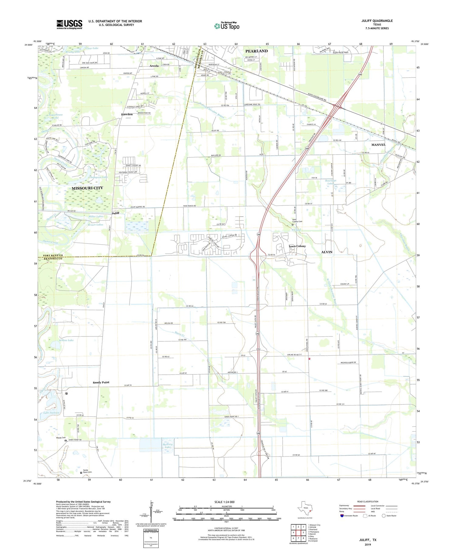
2019 topographic map quadrangle Juliff in the state of Texas. Scale: 1:24000. Based on the newly updated USGS 7.5' US Topo map series, this map is in the following counties: Brazoria, Fort Bend. The map contains contour data, water features, and other items you are used to seeing on USGS maps, but also has updated roads and other features. This is the next generation of topographic maps. Printed on high-quality waterproof paper with UV fade-resistant inks.
Quads adjacent to this one:
West: Thompsons
Northwest: Missouri City
North: Almeda
Northeast: Pearland
East: Manvel
Southeast: Liverpool
South: Rosharon
Southwest: Otey
Contains the following named places: Arcola, Arcola Oil Field, Bayless Airport, Brown Lakes, Brushy Lake, Cenacle Retreat, City of Sandy Point, Clear Lake, Hawdon, Helitrans Heliport, House, Iowa Colony, Iowa Colony Cemetery, Iowa Colony City Hall, Iowa Colony Volunteer Fire Department, Jackson Lake, Juliff, Lake Jackson, Lake Jackson Levee, Lake Sienna, Lawson Lake, Miller Lakes, Mount Tabor Baptist Church, Mowery Lake, Mowery Lake Levee, North Canal, Palestine Missionary Baptist Church, Pilgrim Church, Pilgrim Missonary Baptist Church, Rawlings Lakes, Sandy Point, Sandy Point Cemetery, Sugarhouse Lake, Texas Department of Criminal Justice Darrington Unit, Thompson Lake, Village of Iowa Colony, Willow Lake, Woods Cemetery, ZIP Code: 77583


