MyTopo
Thompsons Texas US Topo Map
Couldn't load pickup availability
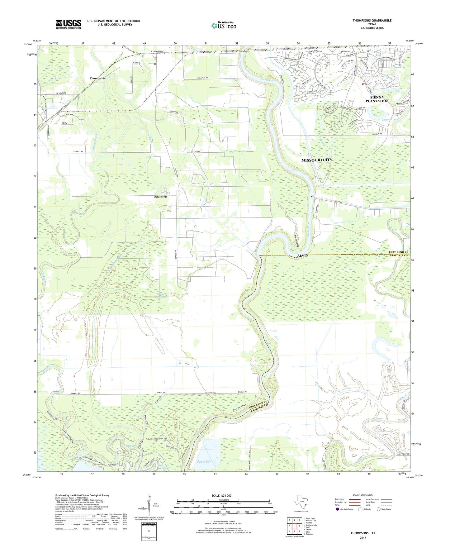
2022 topographic map quadrangle Thompsons in the state of Texas. Scale: 1:24000. Based on the newly updated USGS 7.5' US Topo map series, this map is in the following counties: Fort Bend, Brazoria. The map contains contour data, water features, and other items you are used to seeing on USGS maps, but also has updated roads and other features. This is the next generation of topographic maps. Printed on high-quality waterproof paper with UV fade-resistant inks.
Quads adjacent to this one:
West: Smithers Lake
Northwest: Sugar Land
North: Missouri City
Northeast: Almeda
East: Juliff
Southeast: Rosharon
South: Otey
Southwest: Damon
This map covers the same area as the classic USGS quad with code o29095d5.
Contains the following named places: Booker T Washington School, Brazos Bend State Park, Brazos Bend State Park Trail, Cottonwood Bayou, Cow Bayou, Cow Lake, Dry Bayou, Humble Camp, Rabbs Ridge, Reservoir Number 8, Sacred Heart Church, Sawmill Lake, Sienna, Sienna Plantation, Steep Gully, Thompsons, Thompsons Oil Field, Thompsons Post Office, Thompsons Volunteer Fire Department, Turner Lake, Turner Lake Levee, Waters Lake Bayou, ZIP Code: 77481