MyTopo
Junction Texas US Topo Map
Couldn't load pickup availability
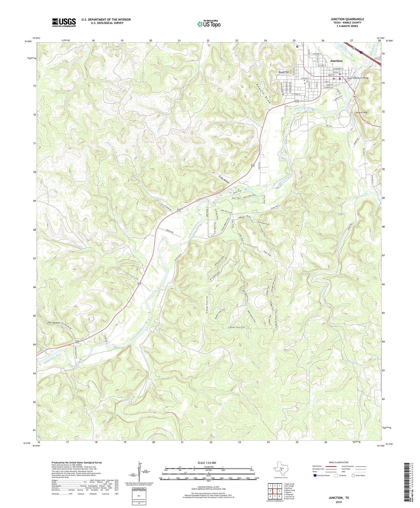
2022 topographic map quadrangle Junction in the state of Texas. Scale: 1:24000. Based on the newly updated USGS 7.5' US Topo map series, this map is in the following counties: Kimble. The map contains contour data, water features, and other items you are used to seeing on USGS maps, but also has updated roads and other features. This is the next generation of topographic maps. Printed on high-quality waterproof paper with UV fade-resistant inks.
Quads adjacent to this one:
West: Bailey Creek
Northwest: Stark Creek
North: Elm Slough
Northeast: Big Draw
East: Segovia
Southeast: Allen Creek
South: Junction SE
Southwest: Telegraph
This map covers the same area as the classic USGS quad with code o30099d7.
Contains the following named places: Cedar Creek, Chalk Creek, Church of Christ, City of Junction, Crisp Hollow, Dry Cedar Creek, First Baptist Church, Fox Hollow, Goodwill Baptist Church, Hill Country Baptist Church, Joy Creek, Junction, Junction City Hall, Junction Elementary School, Junction High School, Junction Middle School, Junction Police Department, Junction Post Office, Junction Volunteer Fire Department, Kimble County Courthouse, Kimble County District Hospital, Kimble County Emergency Medical Services, Kimble County Jail, Kimble County Sheriff's Office, Kimble County WCID Lake, Kimble Historical Museum, KLFO-FM (Junction), KMBL-AM (Junction), Kountz Draw, Lake Junction, Lake Junction Dam, Lovers Leap, North Llano River, Northside Church of Christ, Potter Creek, Round Top, Schreiner Park, Schrier Park, South Llano River, South Llano River State Park, State Highway 27 Bridge, Texas Technical University Center, Trinity Episcopal Church, Walter Buck Wildlife Management Area, Walter Buck Wildlife Management Area Trail, ZIP Code: 76849