MyTopo
Segovia Texas US Topo Map
Couldn't load pickup availability
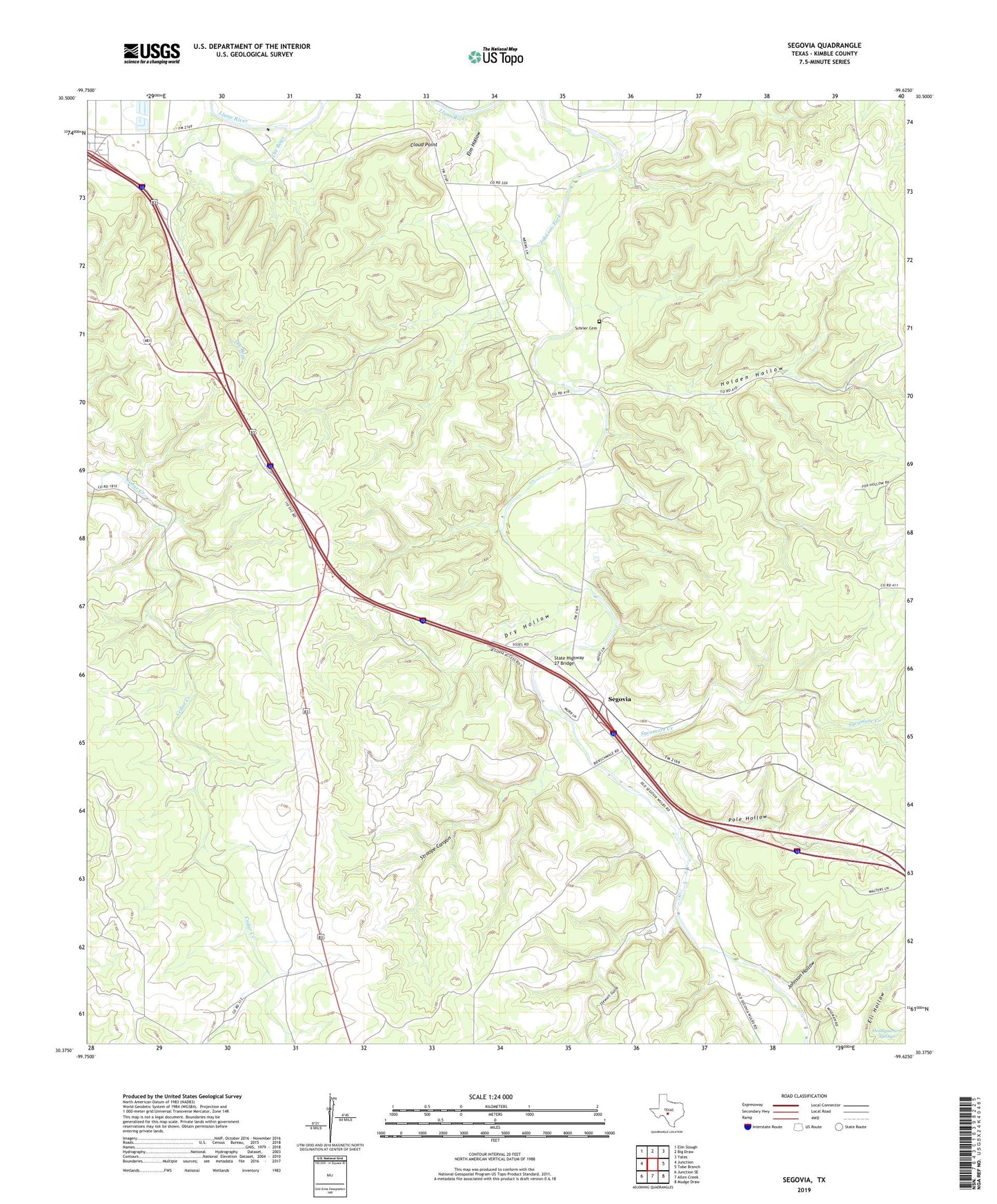
2022 topographic map quadrangle Segovia in the state of Texas. Scale: 1:24000. Based on the newly updated USGS 7.5' US Topo map series, this map is in the following counties: Kimble. The map contains contour data, water features, and other items you are used to seeing on USGS maps, but also has updated roads and other features. This is the next generation of topographic maps. Printed on high-quality waterproof paper with UV fade-resistant inks.
Quads adjacent to this one:
West: Junction
Northwest: Elm Slough
North: Big Draw
Northeast: Yates
East: Tobe Branch
Southeast: Mudge Draw
South: Allen Creek
Southwest: Junction SE
This map covers the same area as the classic USGS quad with code o30099d6.
Contains the following named places: Cloud Point, Dry Hollow, Elm Hollow, Headquarters Springs, Holden Hollow, Johnson Hollow, Kimble County, Pole Hollow, Schrier Cemetery, Segovia, State Highway 27 Bridge, Stewart Gulch, Stroope Canyon, Sycamore Creek, The Bogs