MyTopo
Justin Texas US Topo Map
Couldn't load pickup availability
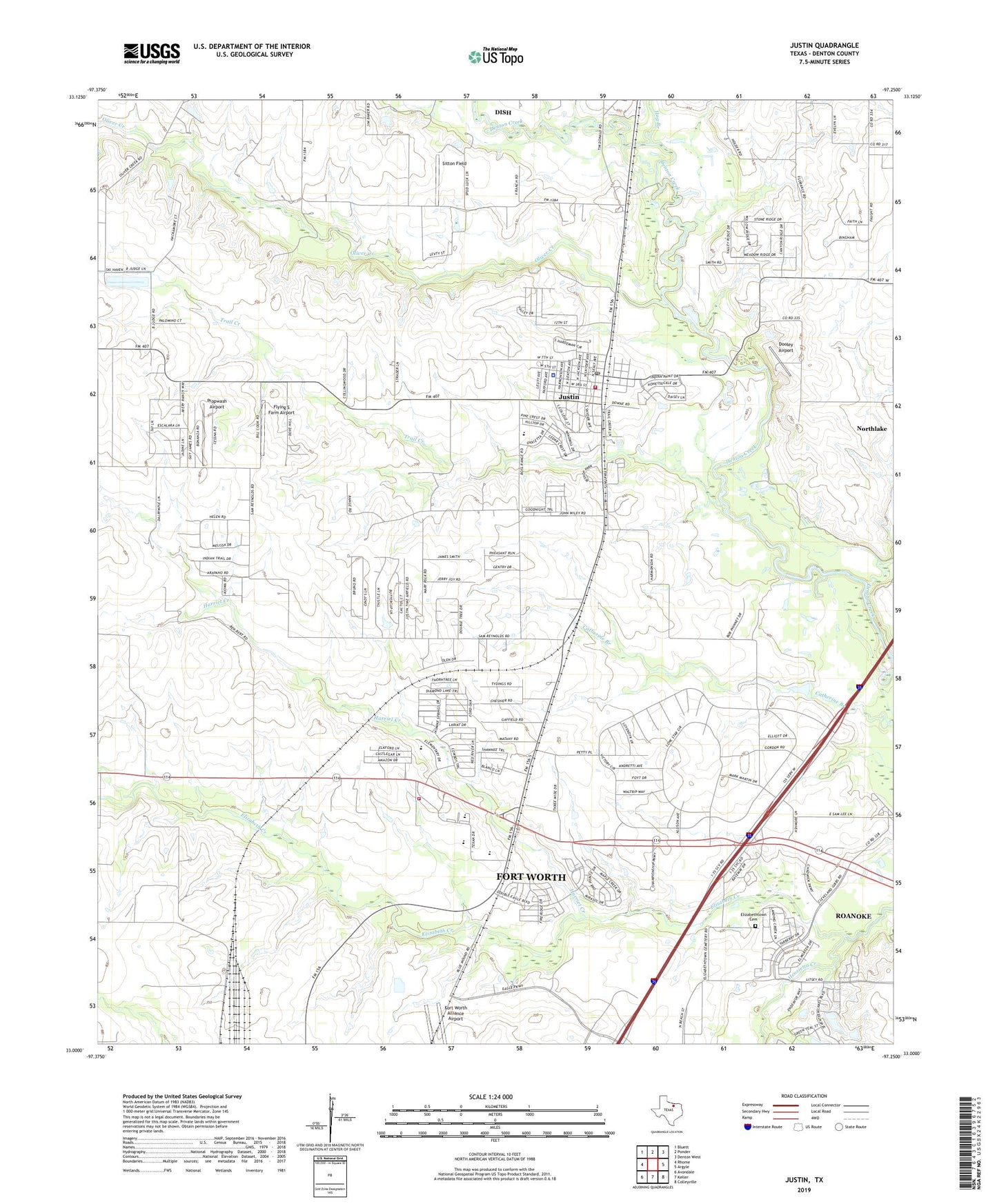
2019 topographic map quadrangle Justin in the state of Texas. Scale: 1:24000. Based on the newly updated USGS 7.5' US Topo map series, this map is in the following counties: Denton. The map contains contour data, water features, and other items you are used to seeing on USGS maps, but also has updated roads and other features. This is the next generation of topographic maps. Printed on high-quality waterproof paper with UV fade-resistant inks.
Quads adjacent to this one:
West: Rhome
Northwest: Bluett
North: Ponder
Northeast: Denton West
East: Argyle
Southeast: Colleyville
South: Keller
Southwest: Avondale
Contains the following named places: American Airlines Emergency Response Team, Bible Baptist Church, Bishop Park, Blue Jay Air Field, Buchannan Lake, Buchannan Lake Dam, City of Justin, City of Justin Wastewater Treatment Plant, Dooley Airport, Elizabethtown, Elizabethtown Cemetery, First Baptist Church, Flying S Farm Airport, Gene Pike Middle School, Harriet Creek, Henrietta Creek, Hog Branch, Justin, Justin Assembly of God Church, Justin Cemetery, Justin Elementary School, Justin Fire Department, Justin Methodist Church, Justin Park, Justin Police Department, Justin Post Office, Justin-Roanoke Division, Northwest High School, Northwest Ninth Grade Center, Oliver Creek, Propwash Airport, Sitton Field, Texan Stadium, Texas Motor Speedway, Texas Motor Speedway Emergency Medical Service Care Center, Town of Northlake, Trail Creek, W R Hatfield Intermediate School, ZIP Code: 76247