MyTopo
Bluett Texas US Topo Map
Couldn't load pickup availability
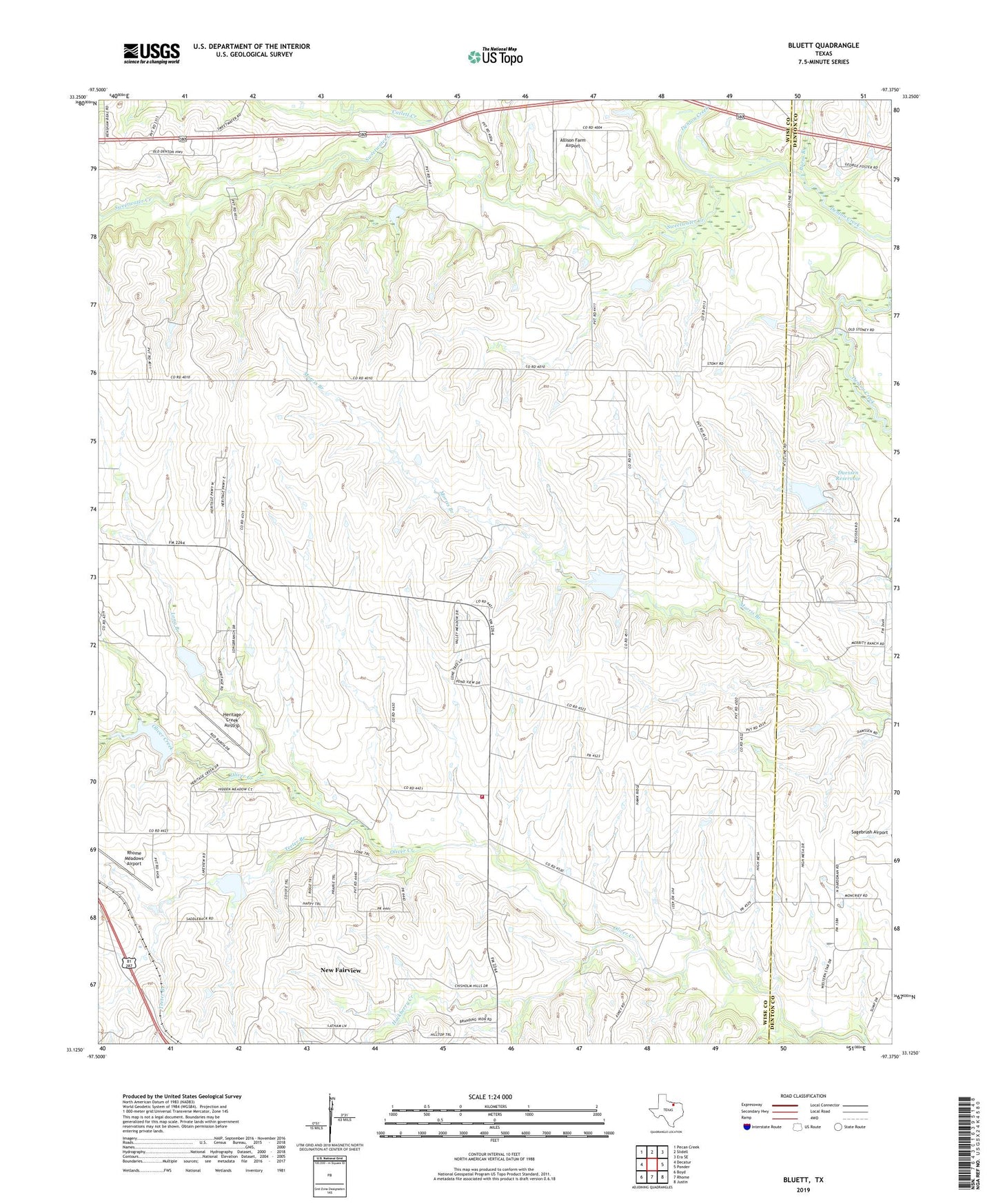
2022 topographic map quadrangle Bluett in the state of Texas. Scale: 1:24000. Based on the newly updated USGS 7.5' US Topo map series, this map is in the following counties: Wise, Denton. The map contains contour data, water features, and other items you are used to seeing on USGS maps, but also has updated roads and other features. This is the next generation of topographic maps. Printed on high-quality waterproof paper with UV fade-resistant inks.
Quads adjacent to this one:
West: Decatur
Northwest: Pecan Creek
North: Slidell
Northeast: Era SE
East: Ponder
Southeast: Justin
South: Rhome
Southwest: Boyd
This map covers the same area as the classic USGS quad with code o33097b4.
Contains the following named places: Allison Farm Airport, Bluett, Burns Branch, Catlett Creek, Corinth Church, Deussen Reservoir Dam, Duessen Reservoir, East Wise Fire and Rescue, Elna Reservoir, Elna Reservoir Dam, Hackberry Creek, Heritage Creek Airstrip, Long Branch, Phoenix Medical Service, Rhome Meadows Airport, Soil Conservation Service Site 24b Dam, Soil Conservation Service Site 24b Reservoir, Soil Conservation Service Site 25a Dam, Soil Conservation Service Site 25a Reservoir, Soil Conservation Service Site 26 Dam, Soil Conservation Service Site 26 Reservoir, Soil Conservation Service Site 27a Dam, Soil Conservation Service Site 27a Reservoir, Soil Conservation Service Site 29 Dam, Soil Conservation Service Site 29 Reservoir, Soil Conservation Service Site 30 Dam, Soil Conservation Service Site 30 Reservoir, Soil Conservation Service Site 31 Dam, Soil Conservation Service Site 31 Reservoir, South Fork Hackberry Creek, Sweetwater Church, Sweetwater Creek, Teeter Branch