MyTopo
Kennard Texas US Topo Map
Couldn't load pickup availability
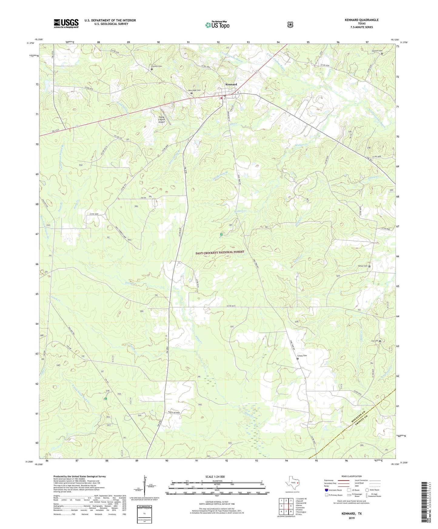
2019 topographic map quadrangle Kennard in the state of Texas. Scale: 1:24000. Based on the newly updated USGS 7.5' US Topo map series, this map is in the following counties: Houston, Trinity. The map contains contour data, water features, and other items you are used to seeing on USGS maps, but also has updated roads and other features. This is the next generation of topographic maps. Printed on high-quality waterproof paper with UV fade-resistant inks.
Quads adjacent to this one:
West: Berea
Northwest: Crockett NE
North: Ratcliff
Northeast: Kennard NE
East: Centralia
Southeast: Crecy
South: Pennington
Southwest: Fodice
Contains the following named places: Allen Chapel, Antioch Cemetery, Antioch Premitive Baptist Church, Antioch Premitive Baptist Church Historical Marker, Brice Spring Branch, Caddenhead Prairie Branch, City of Kennard, Colthorp, Colthorp Historical Marker, Colthorp Post Office, Colthorp Presbyterian Church, Colthorp School, Corinth Cemetery, Creasy Cemetery, Elm Creek, Fairview Church, Flying S Ranch Airport, Fog Town, Helton Cemetery, Ivie Cemetery, Ivie Church, Kennard, Kennard City Hall, Kennard Post Office, Kennard Ratcliff Volunteer Fire Department, Kennard-Ratcliff Division, Lee Creek, Lynch Creek, Mount Olive Methodist Church, New Hope Cemetery, Nogalus Lookout Tower, North Fork Cochino Bayou, Pentecostal Church, Pine Spring Church, Piney Creek Church, Race Track Prairie Branch, Rosenwald School, Rosenwald School Historical Marker, Smith Branch, Smitherman Branch, South Fork Cochino Bayou, Wallace Creek, Wood Spring Branch, ZIP Code: 75847