MyTopo
Kerens Texas US Topo Map
Couldn't load pickup availability
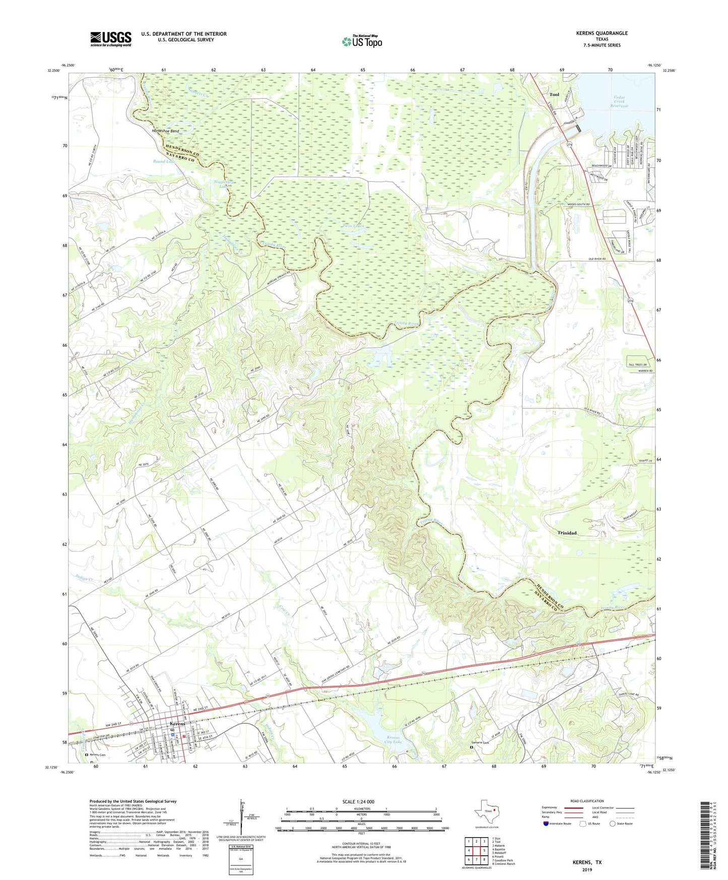
2019 topographic map quadrangle Kerens in the state of Texas. Scale: 1:24000. Based on the newly updated USGS 7.5' US Topo map series, this map is in the following counties: Navarro, Henderson. The map contains contour data, water features, and other items you are used to seeing on USGS maps, but also has updated roads and other features. This is the next generation of topographic maps. Printed on high-quality waterproof paper with UV fade-resistant inks.
Quads adjacent to this one:
West: Bazette
Northwest: Styx
North: Tool
Northeast: Mabank
East: Malakoff
Southeast: Creslenn Ranch
South: Goodlow Park
Southwest: Powell
Contains the following named places: Bazette Oil Field, City of Kerens, First Methodist Church, Horseshoe Bend, Humphries Creek, Kerens, Kerens Cemetery, Kerens City Hall, Kerens City Lake, Kerens City Lake Dam, Kerens Police Department, Kerens Post Office, Kerens Volunteer Fire Department, New Hope Baptist Church, Oak Grove Church, Round Lake, Samaria, Samarie Cemetery, Sanders Creek, Singletary Lake, Twin Lakes