MyTopo
Mabank Texas US Topo Map
Couldn't load pickup availability
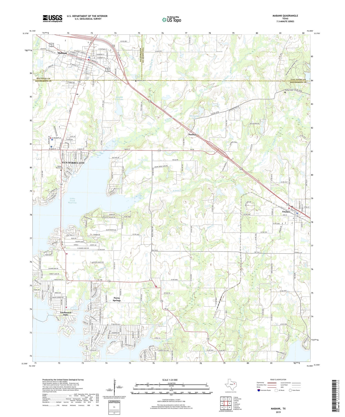
2022 topographic map quadrangle Mabank in the state of Texas. Scale: 1:24000. Based on the newly updated USGS 7.5' US Topo map series, this map is in the following counties: Henderson, Van Zandt, Kaufman. The map contains contour data, water features, and other items you are used to seeing on USGS maps, but also has updated roads and other features. This is the next generation of topographic maps. Printed on high-quality waterproof paper with UV fade-resistant inks.
Quads adjacent to this one:
West: Tool
Northwest: Kemp
North: Prairieville
Northeast: Phalba
East: Stockard
Southeast: Mallard Hill
South: Malakoff
Southwest: Kerens
This map covers the same area as the classic USGS quad with code o32096c1.
Contains the following named places: Abernathy Lake, Abernathy Lake Dam, Boulevard Park, Cedar Branch, Central Elementary School, Church of the Nazarene, City of Eustace, Dry Creek, Elam Grove Church, Enchanted Oaks, Enchanted Oaks City Hall, Enchanted Oaks Volunteer Fire Department, Eustace, Eustace Area Volunteer Fire Department, Eustace Police Department, Eustace Post Office, First Baptist Church of Mabank, First Presbyterian Church of Mabank, Goshen Cemetery, Gun Barrel City Fire Department, Gun Barrel City Police Department, John Santerre Lake, John Santerre Lake Dam, Little Dry Branch, Mabank, Mabank Cemetery, Mabank City Hall, Mabank City Lake, Mabank City Lake Dam, Mabank Fire Department Central Fire Station, Mabank High School, Mabank Middle School, Mabank Police Department, Mabank Post Office, Mason Ranch Cemetery, Medical Emergency Gbc Heliport, Mill Creek, North Twin Creek, Pauline, Payne Springs, Payne Springs City Hall, Payne Springs Fire Rescue Station 2, Purtis Creek, Saint Peter Lutheran Church, South Twin Creek, Town of Enchanted Oaks, Town of Mabank, Town of Payne Springs, ZIP Code: 75156