MyTopo
Creslenn Ranch Texas US Topo Map
Couldn't load pickup availability
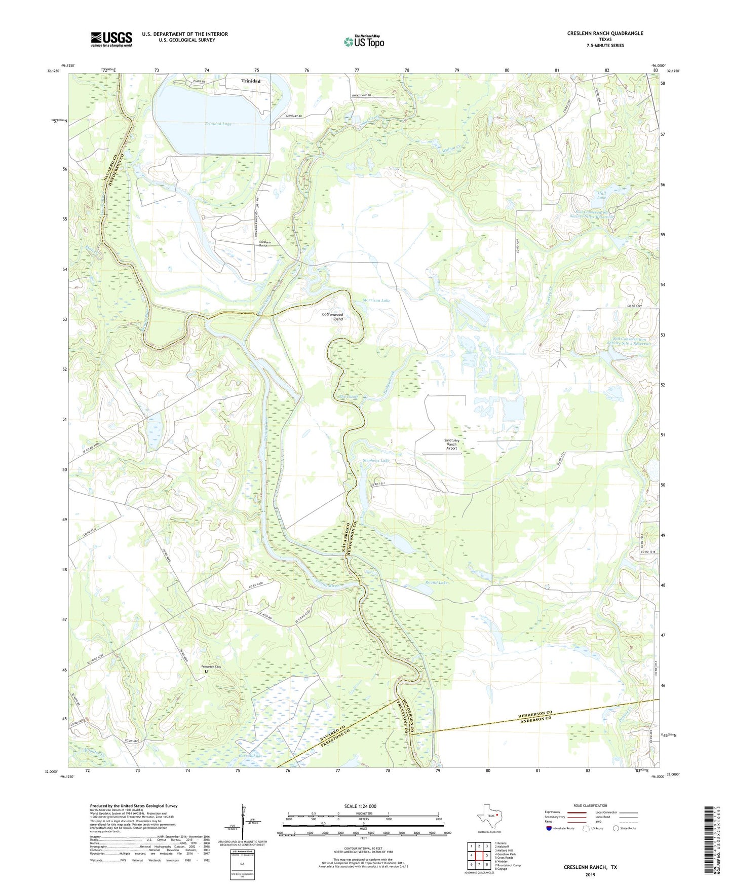
2022 topographic map quadrangle Creslenn Ranch in the state of Texas. Scale: 1:24000. Based on the newly updated USGS 7.5' US Topo map series, this map is in the following counties: Henderson, Navarro, Anderson, Freestone. The map contains contour data, water features, and other items you are used to seeing on USGS maps, but also has updated roads and other features. This is the next generation of topographic maps. Printed on high-quality waterproof paper with UV fade-resistant inks.
Quads adjacent to this one:
West: Goodlow Park
Northwest: Kerens
North: Malakoff
Northeast: Mallard Hill
East: Cross Roads
Southeast: Cayuga
South: Roustabout Camp
Southwest: Winkler
This map covers the same area as the classic USGS quad with code o32096a1.
Contains the following named places: Cedar Creek, Cottonwood Bend, Creslenn Park, Creslenn Ranch, Creslenn Ranch Dam, Creslenn Ranch Lake, Gallimo Lake, Hall Lake, Jackson Lake, Long Lake, McAllister Slough, Morrison Lake, Navasota Public Library, Princeton Cemetery, Round Lake, Rush Creek, Sanctuary Ranch Airport, Soil Conservation Service Site 1 Dam, Soil Conservation Service Site 1 Reservoir, Soil Conservation Service Site 3 Dam, Soil Conservation Service Site 3 Reservoir, Soil Conservation Service Site 4 Dam, Soil Conservation Service Site 4 Reservoir, South Malakoff Oil Field, Stephens Lake, Texas Utilities Company Airport, The Cutoff, Trinidad Lake, Trinidad Levee, Turkey Creek, Walnut Creek