MyTopo
Saratoga Texas US Topo Map
Couldn't load pickup availability
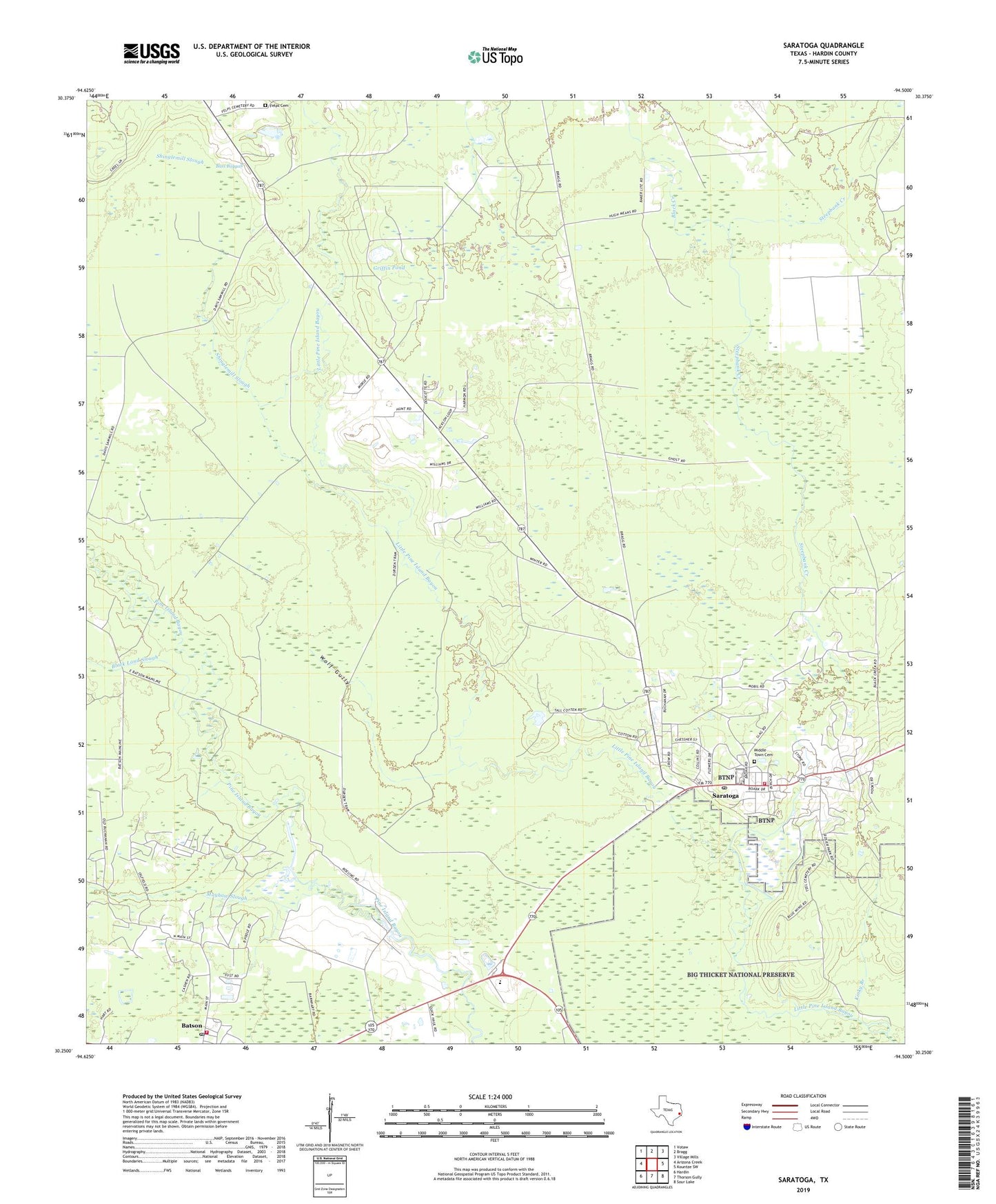
2022 topographic map quadrangle Saratoga in the state of Texas. Scale: 1:24000. Based on the newly updated USGS 7.5' US Topo map series, this map is in the following counties: Hardin. The map contains contour data, water features, and other items you are used to seeing on USGS maps, but also has updated roads and other features. This is the next generation of topographic maps. Printed on high-quality waterproof paper with UV fade-resistant inks.
Quads adjacent to this one:
West: Arizona Creek
Northwest: Votaw
North: Bragg
Northeast: Village Mills
East: Kountze SW
Southeast: Sour Lake
South: Thorson Gully
Southwest: Hardin
This map covers the same area as the classic USGS quad with code o30094c5.
Contains the following named places: Ada Belle Oil Well, Bass Baygall, Batson Oil Field, Batson Post Office, Batson Volunteer Fire Department, Big Thicket, Big Thicket Museum, Black Creek, Black Land Slough, Felps Cemetery, Griffin Pond, Kinky Branch, Mayhaw Slough, Middle Town Cemetery, Saratoga, Saratoga Oil Field, Saratoga Post Office, Saratoga Volunteer Fire Department, Saratoga-Batson Division, Shinglemill Slough, West Hardin Elementary School, West Hardin High School, West Hardin Junior High School, Wolf Gully, ZIP Code: 77585