MyTopo
Lady Bird Johnson Park Texas US Topo Map
Couldn't load pickup availability
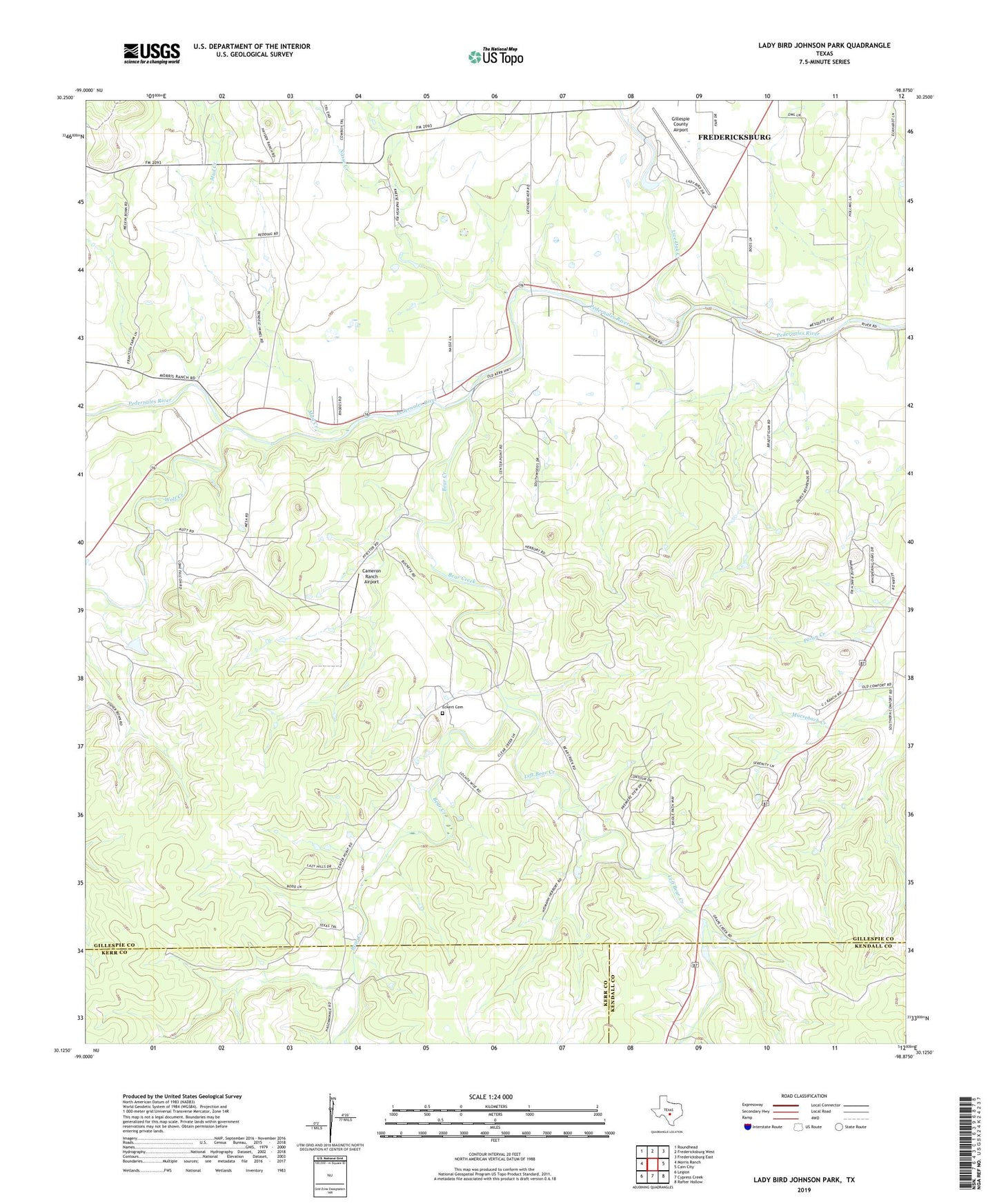
2019 topographic map quadrangle Lady Bird Johnson Park in the state of Texas. Scale: 1:24000. Based on the newly updated USGS 7.5' US Topo map series, this map is in the following counties: Gillespie, Kerr, Kendall. The map contains contour data, water features, and other items you are used to seeing on USGS maps, but also has updated roads and other features. This is the next generation of topographic maps. Printed on high-quality waterproof paper with UV fade-resistant inks.
Quads adjacent to this one:
West: Morris Ranch
Northwest: Roundhead
North: Fredericksburg West
Northeast: Fredericksburg East
East: Cain City
Southeast: Rafter Hollow
South: Cypress Creek
Southwest: Legion
Contains the following named places: Bear Creek, Cameron Ranch Airport, Eckert Cemetery, Gillespie County Airport, Lady Bird Johnson Municipal Park, Lady Bird Johnson Park Dam, Lady Bird Johnson Park Reservoir, Lady Bird Johnson Park Trail, Left Bear Creek, Live Oak Creek, Meusebach Creek, Mud Creek, Nasse Creek, Oak Crest Park, Stink Creek, Wolf Creek, Wrede Community House