MyTopo
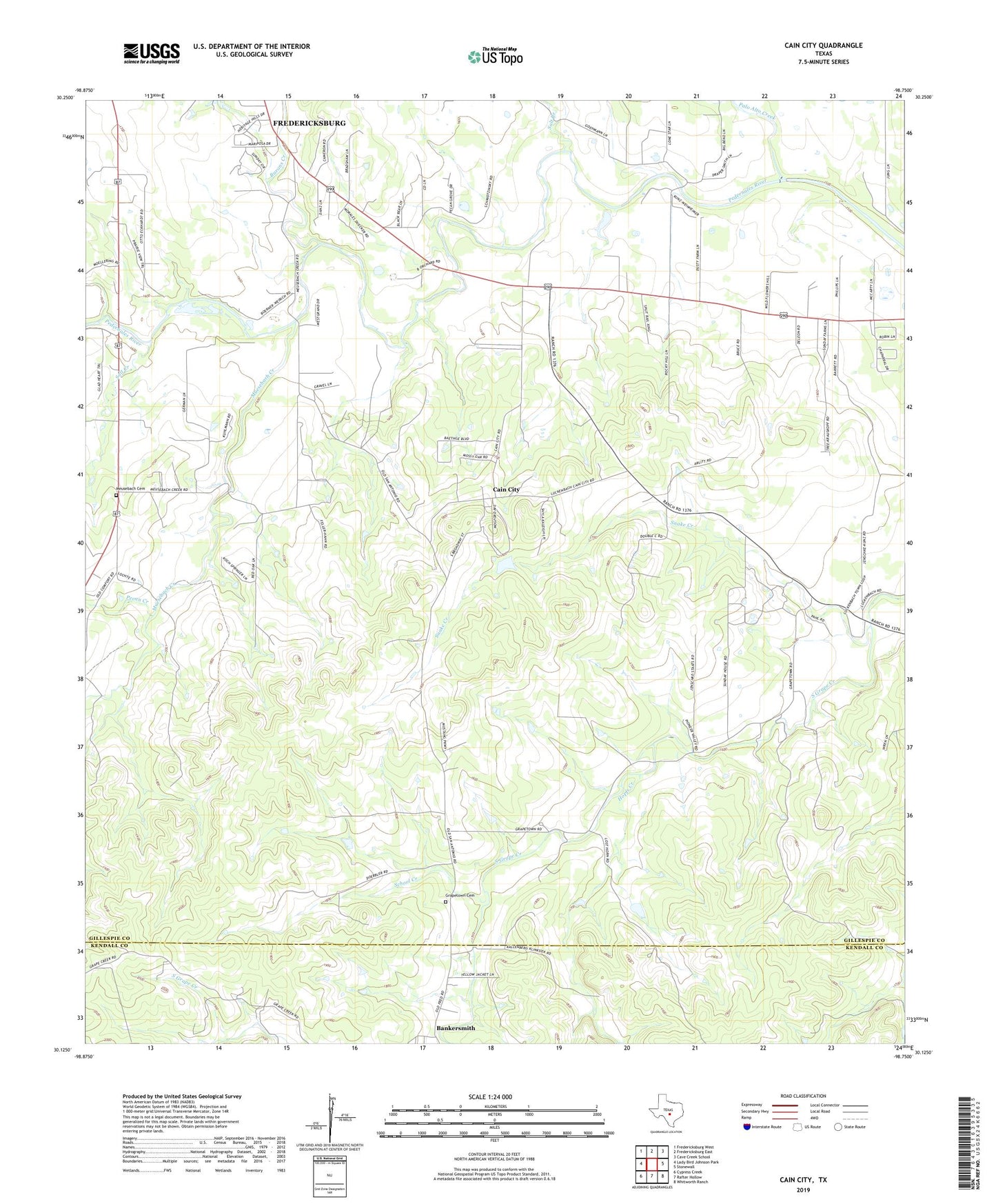
Cain City Texas US Topo Map
Couldn't load pickup availability
2022 topographic map quadrangle Cain City in the state of Texas. Scale: 1:24000. Based on the newly updated USGS 7.5' US Topo map series, this map is in the following counties: Gillespie, Kendall. The map contains contour data, water features, and other items you are used to seeing on USGS maps, but also has updated roads and other features. This is the next generation of topographic maps. Printed on high-quality waterproof paper with UV fade-resistant inks.
Quads adjacent to this one:
West: Lady Bird Johnson Park
Northwest: Fredericksburg West
North: Fredericksburg East
Northeast: Cave Creek School
East: Stonewall
Southeast: Whitworth Ranch
South: Rafter Hollow
Southwest: Cypress Creek
This map covers the same area as the classic USGS quad with code o30098b7.
Contains the following named places: Bankersmith, Barons Creek, Cain City, Grapetown, Grapetown Cemetery, Heritage Creek, Luckenbach, Luckenbach School, Meusebach Cemetery, Meusebach School, Muesebach Creek, Palo Alto Creek, Pecan Creek, Rocky Hill, Salt Branch, Salt Creek, School Creek, Snake Creek