
MyTopo
Lajitas Texas US Topo Map
Couldn't load pickup availability
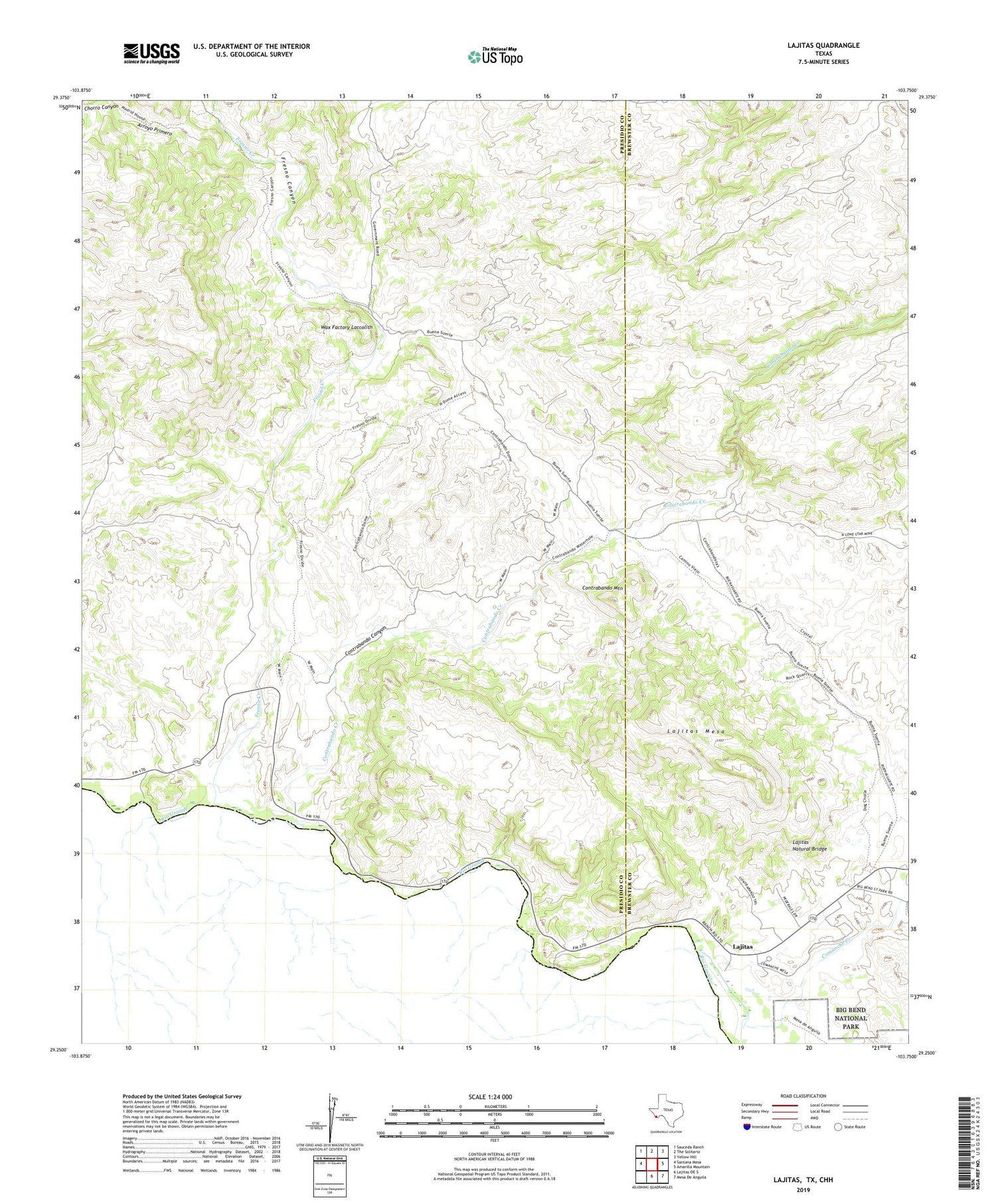
2019 topographic map quadrangle Lajitas in the state of Texas. Scale: 1:24000. Based on the newly updated USGS 7.5' US Topo map series, this map is in the following counties: Presidio, Brewster. The map contains contour data, water features, and other items you are used to seeing on USGS maps, but also has updated roads and other features. This is the next generation of topographic maps. Printed on high-quality waterproof paper with UV fade-resistant inks.
Quads adjacent to this one:
West: Santana Mesa
Northwest: Sauceda Ranch
North: The Solitario
Northeast: Yellow Hill
East: Amarilla Mountain
Southeast: Mesa De Anguila
South: Lajitas OE S
Contains the following named places: Arroyo Primero, Barton Warnock Environmental Education Center, Chorro Canyon, Contrabando Canyon, Contrabando Creek, Contrabando Mountain, Contrabando Waterhole, Fresno Canyon, Fresno Creek, Fresno Mine, Lajitas, Lajitas Airport, Lajitas Boat Crossing, Lajitas Cemetery, Lajitas Crossing, Lajitas Mesa, Lajitas Natural Bridge, Lajitas Vehicle Crossing, Madrid Ranch, Wax Factory Laccolith, Whitroy Mine


