MyTopo
Amarilla Mountain Texas US Topo Map
Couldn't load pickup availability
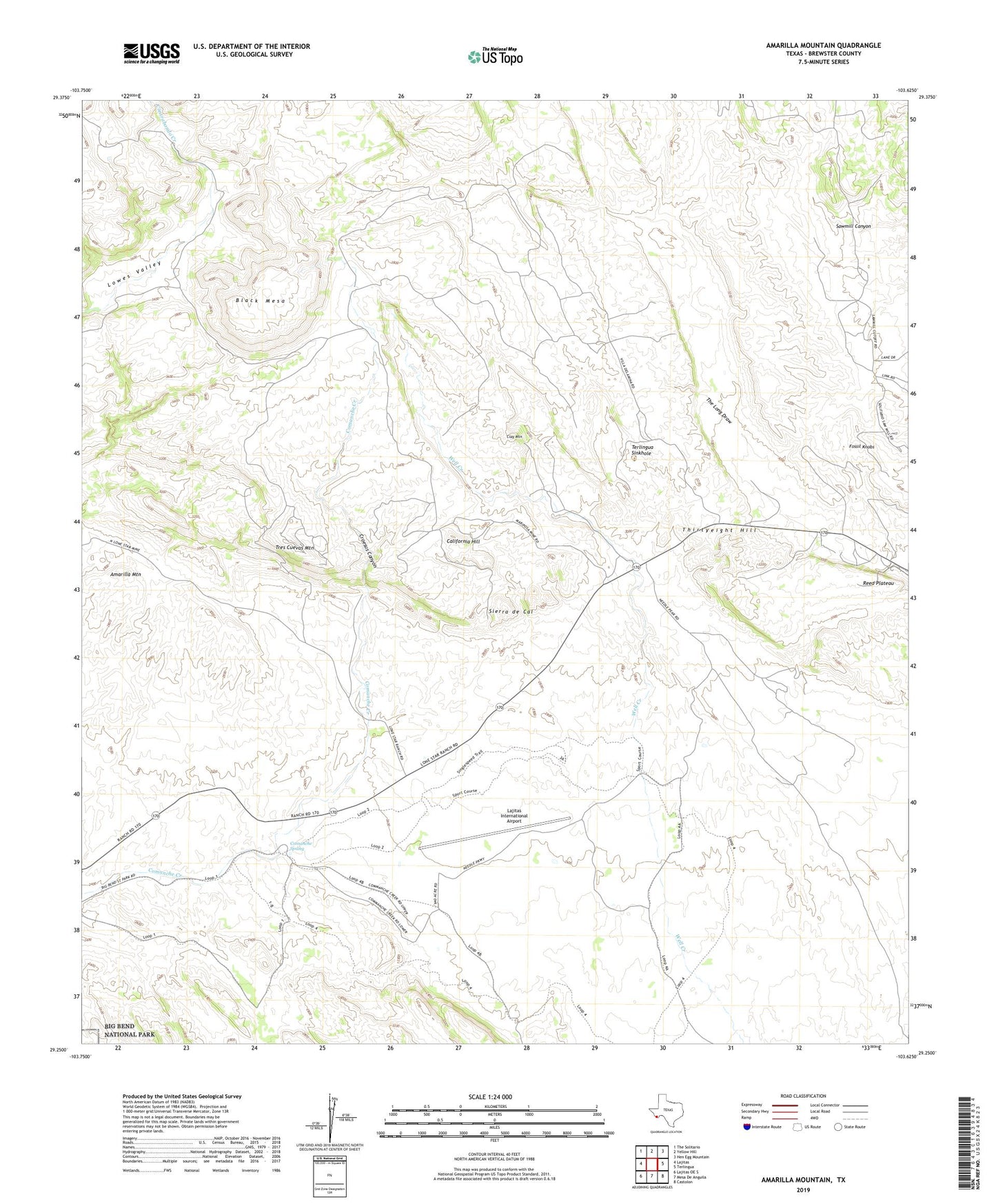
2022 topographic map quadrangle Amarilla Mountain in the state of Texas. Scale: 1:24000. Based on the newly updated USGS 7.5' US Topo map series, this map is in the following counties: Brewster. The map contains contour data, water features, and other items you are used to seeing on USGS maps, but also has updated roads and other features. This is the next generation of topographic maps. Printed on high-quality waterproof paper with UV fade-resistant inks.
Quads adjacent to this one:
West: Lajitas
Northwest: The Solitario
North: Yellow Hill
Northeast: Hen Egg Mountain
East: Terlingua
Southeast: Castolon
South: Mesa De Anguila
Southwest: Lajitas OE S
This map covers the same area as the classic USGS quad with code o29103c6.
Contains the following named places: Alpine Public Library, Amarilla Mountain, Black Mesa, California Hill, Clay Mountain, Coltrins Camp, Comanche Spring, Croesus Canyon, Fossil Knobs, Lajitas International Airport, Little Thirty-Eight Mine, Lone Star Mine, Lowes Tinaja, Lowes Valley, Maggie Mine, Mariposa Mine, Reed Plateau, Sierra de Cal, Terlingua Sinkhole, Thirtyeight Hill, Tres Cuevas Mountain, Waldron Mine