MyTopo
Yellow Hill Texas US Topo Map
Couldn't load pickup availability
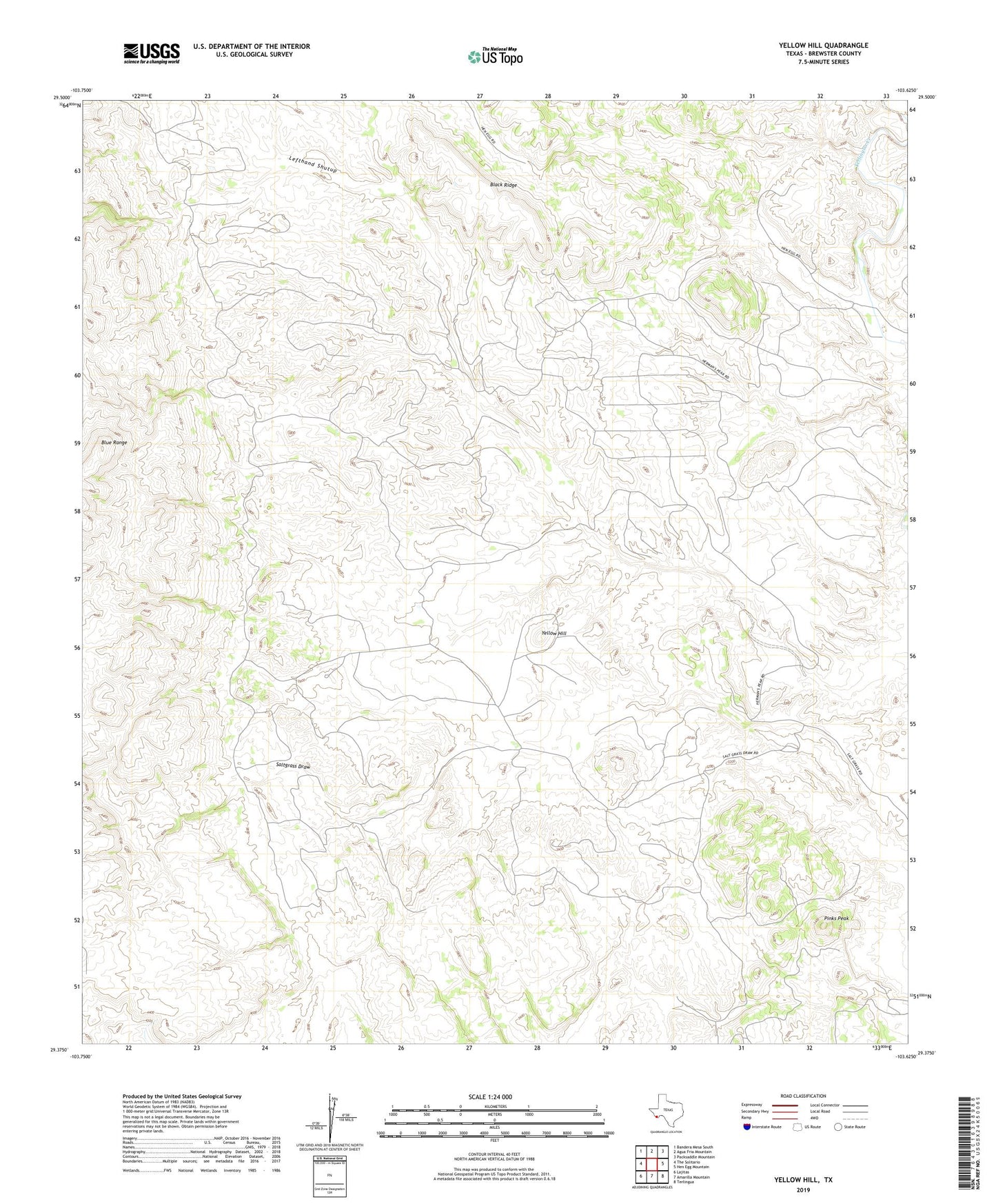
2022 topographic map quadrangle Yellow Hill in the state of Texas. Scale: 1:24000. Based on the newly updated USGS 7.5' US Topo map series, this map is in the following counties: Brewster. The map contains contour data, water features, and other items you are used to seeing on USGS maps, but also has updated roads and other features. This is the next generation of topographic maps. Printed on high-quality waterproof paper with UV fade-resistant inks.
Quads adjacent to this one:
West: The Solitario
Northwest: Bandera Mesa South
North: Agua Fria Mountain
Northeast: Packsaddle Mountain
East: Hen Egg Mountain
Southeast: Terlingua
South: Amarilla Mountain
Southwest: Lajitas
This map covers the same area as the classic USGS quad with code o29103d6.
Contains the following named places: Black Ridge, Lefthand Shutup, Pinks Peak, Yellow Hill