MyTopo
Lake Theo Texas US Topo Map
Couldn't load pickup availability
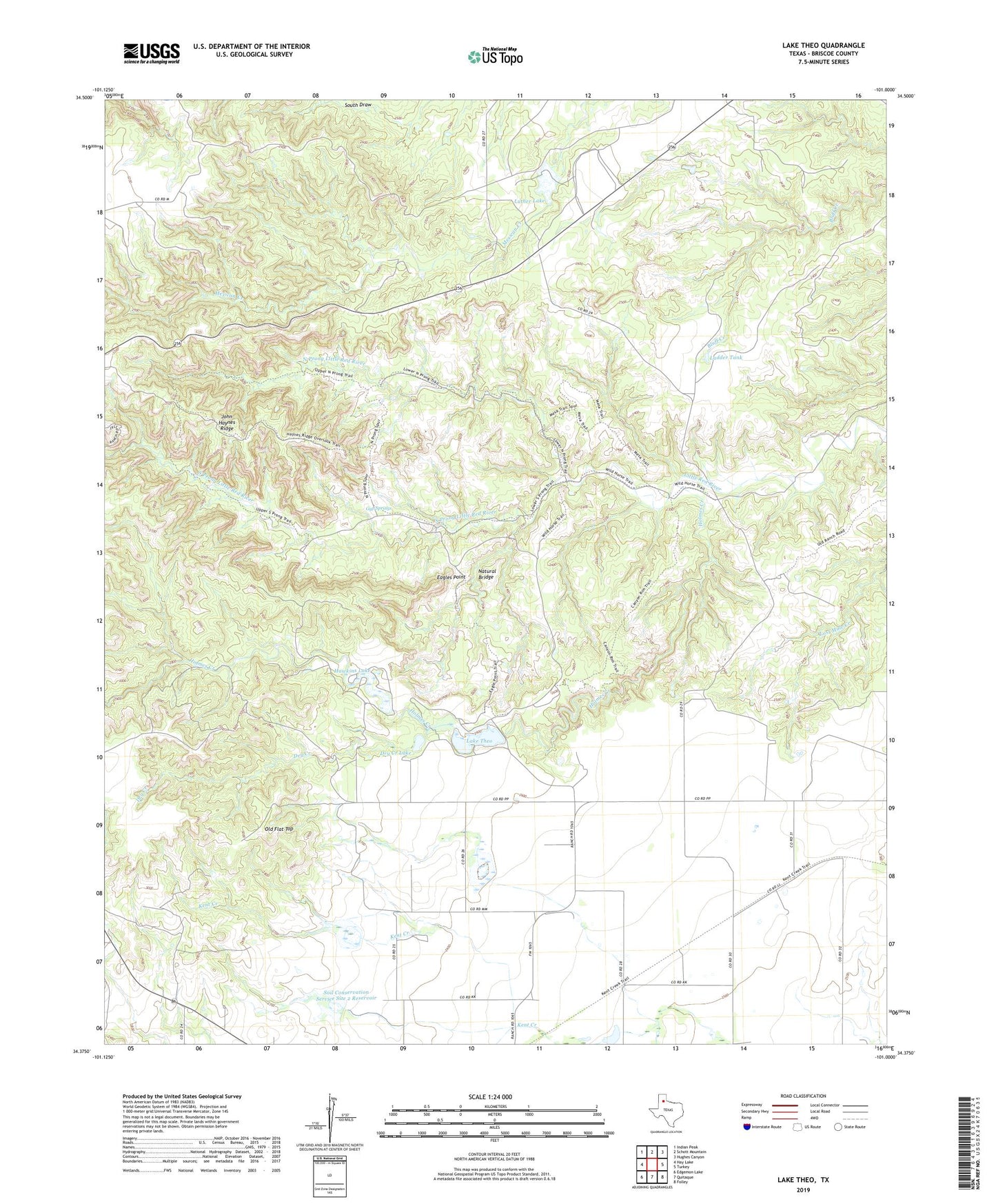
2019 topographic map quadrangle Lake Theo in the state of Texas. Scale: 1:24000. Based on the newly updated USGS 7.5' US Topo map series, this map is in the following counties: Briscoe. The map contains contour data, water features, and other items you are used to seeing on USGS maps, but also has updated roads and other features. This is the next generation of topographic maps. Printed on high-quality waterproof paper with UV fade-resistant inks.
Quads adjacent to this one:
West: Hay Lake
Northwest: Indian Peak
North: Schott Mountain
Northeast: Hughes Canyon
East: Turkey
Southeast: Folley
South: Quitaque
Southwest: Edgemon Lake
Contains the following named places: Caprock Canyons State Park, Caprock Canyons State Park and Trailway, Collier Tank, Collier Tank Dam, Dry Creek, Dry Creek Lake, Eagles Point, Gyp Springs, Hawkins Lake, Hawkins Lake Dam, Holmes Creek, John Haynes Ridge, Ladder Tank, Lake Theo, Lake Theo Dam, Luther Lake, Luther Lake Dam, Natural Bridge, North Prong Little Red River, Old Flat Top, Quitaque Division, Soil Conservation Service Site 1 Dam, Soil Conservation Service Site 1 Reservoir, Soil Conservation Service Site 2 Dam, Soil Conservation Service Site 2 Reservoir, Soil Conservation Service Site 3 Dam, Soil Conservation Service Site 3 Reservoir, South Prong Little Red River